Self-Guided Walking Tour of Panama Viejo - Panama Viejo Purple Travel Guide
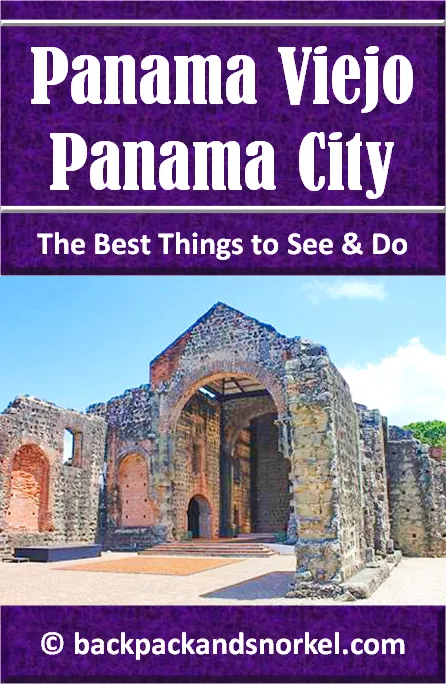
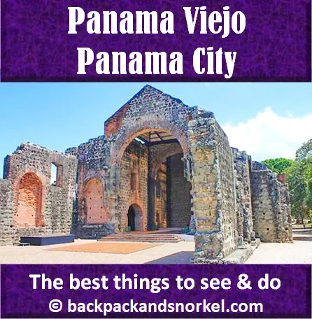
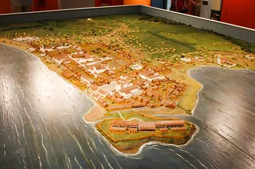
Panamá Viejo, or Panamá la Vieja, are the remains of the original Panama City settlement that was looted by pirates in 1671 and subsequently burned down. It is a World Heritage Site and one of the top tourist attractions in Panama City. This Panama Viejo Purple Travel Guide provides a self-guided walking tour of Panama Viejo in Panama City.
Settled in 1519, it was the first permanent European settlement on the Pacific Ocean. In 1521, it was promoted to become a “city” and it became a launching point for expeditions to Peru and, later on, an important part of the route on which much of the gold and silver the Spaniards robbed from the natives was transported to Spain.
Over the years, the city has suffered through multiple fires, attacks from pirates and indigenous people and even an earthquake. But nothing was as devastating as the fire in 1671 that the city, which now counted 10,000 inhabitants, suffered after the Welsh pirate Henry Morgan looted the city with his army of 1,400 men. It is unclear if the pirates set the city ablaze or if General de Guzmán caused the fire by exploding the gunpowder magazines.
The ruins were never rebuilt and instead, Panama City was reestablished about 5 miles (8km) away from this spot two years later at a place that is now known as Casco Viejo.
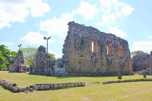
The ruins that you see today in Panamá Viejo are just that: ruins. But they shed a light into how buildings looked about 450 years ago.
Hours of Operation: Tuesday to Sunday, 8:30 am to 4:30 pm
Admission: non-Panamanian adults: $15 (Visa and Master Card accepted with photo ID)
Recommended time: 2h
Parking: free parking
Tours: Guided tours are available, but need to ask at front desk
Here at Backpack and Snorkel Travel Guides, we typically promote self-guided walking tours.
But we realize that not everybody likes to walk by themselves in a foreign city. So, just in case that you rather go with ab guide: NO PROBLEM! Please see the free GuruWalk and paid Viator tours below.
free GuruWalk tours
paid Viator tours
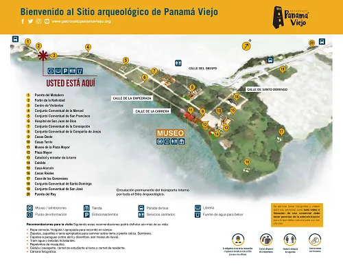
The map of Panama Viejo lists 20 sites and 4 streets. Here is what they are:
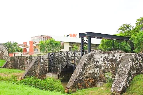
1. PUENTE DEL MATADERO (SLAUGHTERHOUSE BRIDGE)
Don’t let the name slaughterhouse bridge deter you. This stone bridge from 1607, which likely replaced an older wooden bridge, got its name from a nearby slaughterhouse. In the past, this bridge was the entrance to Panama City. It was built, because it was difficult and dangerous to get into the city and leave it during high tide. Not just because people would need to swim across the river, but also because the caimans that lived here were trying to fest on them.
It is speculated that pirate Henry Morgan and his men entered the city through the bridge.
2. FORTÍN DE LA NATIVIDAD (NATIVITY FORT)
Behind the bridge lies Fortín de la Natividad, a small fort that was likely built around 1616 as the main defense for the city from the West. It could hold up to 12 soldiers and four cannons. The fort was restored in the mid-20th century.
3. CONJUNTO CONVENTUAL DE LA MERCED (LA MERCED CONVENT)
The church of the Mercedarian friars (Order of the Blessed Virgin Mary of Mercy) had four confraternities (Our Lady of Solitude, Our Lady of Candelaria, Our Lady of Saint Katherine, and Our Lady of the Holy Waters), each one likely with its own alter. The church was the least damaged by the 1671 fire, but when Panama City was resettled 5 miles away, the church façade was moved to its new location in the Old Quarter where you can still see it and the other walls were used to build the new city walls.
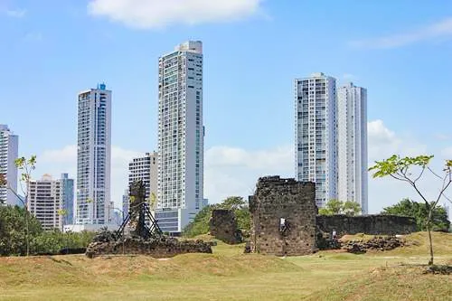
4. CONJUNTO CONVENTUAL DE SAN FRANCISCO (PANAMÁ VIEJO CATHEDRAL)
The Franciscan order was the first to arrive in the 1520s. The friars lived in a provisional building until 1573, then moved to this place which grew over time and eventually occupied two blocks. It included a dormitory, church, and a cloister with a patio which was surrounded by windowless walls. The church had four confraternities (Our Lady of Conception, the Veracruz of San Diego, Our Lady of Remedios and Saint John of Buenaventura) and a chapel which was dedicated to Saint Anthony with an engraving of Saint Francis, an altar of Saint Cosme and Saint Damian, and one dedicated to Saint Eloy.
5. HOSPITAL DE SAN JUAN DE DIOS (SAN JUAN DE DIOS HOSPITAL)
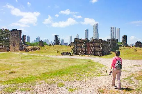
Originally called the Saint Sebastian Hospital, the hospital was founded two years after the city. In its beginning, the hospital had scarce financial means and could only cover emergencies and basic needs. Despite that, it was continuously overflowing with patients and even closed down for some time due to a lack of financing.
In 1620, the city decided to put the San Juan de Dios order in charge of the hospital. Under new management and the new name, the mortality rate was reduced and the hospital was updated and expanded. Eventually, the wooden structure became stone building, which also included a church, cloisters, salons, and a Military Hospital which grew to take up an entire city block. Up to 150 people were treated in the hospital.
6. CONJUNTO CONVENTUAL DE LA CONCEPCIÓN (LA CONCEPCIÓN CONVENT)
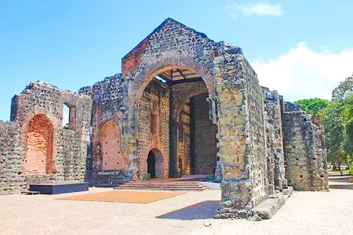
This Our Lady of Conception church was the headquarters of the only female religious congregation in Panama and it is one of the largest in Panama Viejo. It was founded in 1598 by four nuns who arrived from Lima. The original building was heavily damaged by the 1621 earthquake and construction of a new stone church started in 1640. When the 1671 fire broke out, it was still unfinished.
Today, you can still see ruins of the masonry walls and four vaults supported by stone arches and columns surrounding the only cistern in Panama Viejo which held more than 124,000 liters of water.
7. CONJUNTO CONVENTUAL DE LA COMPAÑÍA DE JESÚS (LA COMPAÑÍA DE JESÚS CONVENT)
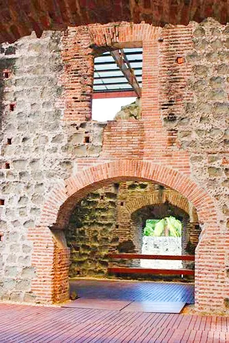
The ruins that you see today are the church and the main cloisters which were built after the 1621 earthquake. The original structure was built of wood and converted to stone walls in the early 17th century using drawings that Father Andrés Alonso de Valladolid, who was an architect, created in 1610.
The church had two entrances: the main entrance toward the East and a second on Empedrada Street. A third door connected to the cloisters. The refectory was on the ground floor and it is speculated that the cells were on the upper floor. The church three naves and the main cloisters a wooden gallery.
Stones were fit together using clay instead of lime mortar.
The location at Plaza Mayor between Empedrada and Obispo Streets points at the high status of the church. It was probably only surpassed by the Cathedral and it was actually used as a replacement when the Cathedral was under construction or renovation.
The Jesuit order residing here was dedicated to public education and to catechizing indigenous people.
8. CASAS OESTE (WEST HOUSES)
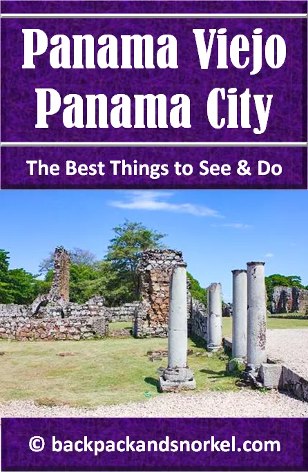
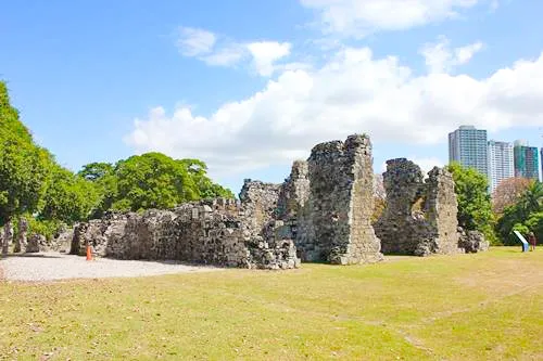
Located to the West of Plaza Mayor, the houses between Carrera and Empedrada streets were most likely detached two story residences. Due to their proximity to the Main Square, it is likely that they belonged to the upper class.
It appears that the houses had wooden walls built on stone bases. What you can see today are the stone bases of the original columns.
9. CASAS TERRÍN (TERRÍN HOUSES)
Built in the 17th century by Francisco Terrín, the ruins of a few high class houses remain. The houses had stone bases, wooden walls on top, small inner courts, open-air kitchens, separate quarters for servants, and a large arch towards Plaza Mayor.

10. PLAZA MAYOR (MAIN PLAZA)
Plaza Mayor was the social, cultural, economic, religious and political center of town. It was enlarged at around the year 1600. To the West and North are the Casas Terrin and Casas Oeste while the Cathedral and City Hall stand to the East.
11. CATEDRAL Y MIRADOR DE LA TORRE (CATHEDRAL)
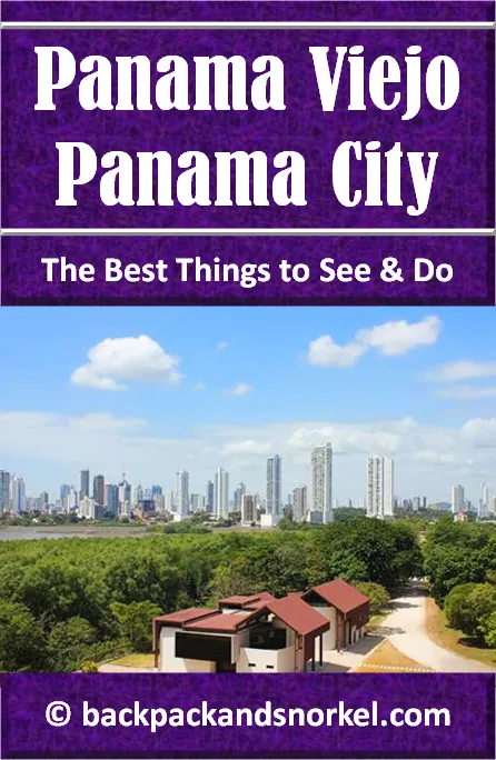
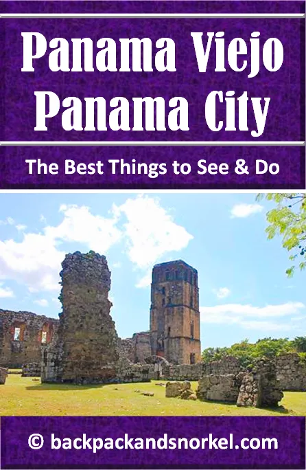
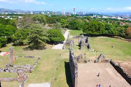
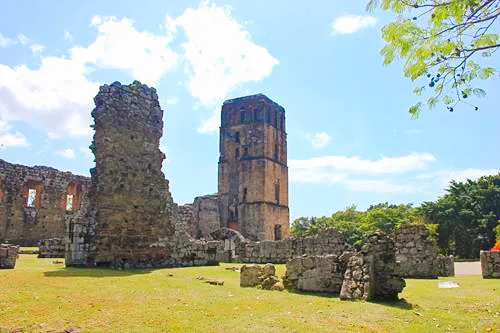
The stone walled cathedral that you see today is at least the 4th cathedral on this site. The first 3 were wooden structures with the first one being built here in 1535. The current masonry structure was built between 1619 and 1626 and its tower was used as a belfry and watchtower. Today, you can climb up 115 steps and use it as a lookout on 3 levels for wonderful panoramic views of Panama Viejo and modern Panama City.
12. CABILDO (TOWN HALL)
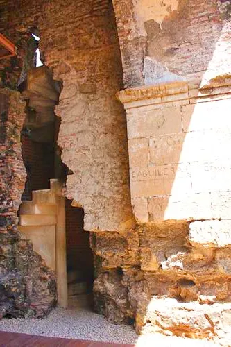
In the first years since Panama City was granted its title as a city, the town halls were modest wooden houses. It took until 1583 that the first masonry Town Hall was built. It had two floors and was separated from the Cathedral by a hallway. The 1621 earthquake destroyed the building and a new Town Hall was built on the same spot by 1640.
The ground floor consisted of a room facing the Plaza, two stores on the street, and a back patio. The upper floor had a room for the town hall sessions and offices. Today, you can still see the pebble-stone floor from the lower gallery and a stone staircase that led to the upper floor.

13. CASA ALARCÓN (ALARCÓN HOUSE)
Originally on this site stood a rental home that was built in 1590. The rent was used by the church to fund rebuilding the Cathedral. The house was typically occupied by bishops and thus became known as the Bishops House.
In 1640 the house was auctioned off and the new owner, Pedro de Alarcón, demolished it to build a the grand stone house whose ruins we see today. Casa Alarcón’s size of 900 m2 suggests that it may have been the largest house in the city at that time. Due to its prime location, the house became popular spot to host the most distinguished visitors.
14. CASAS REALES (ROYAL HOUSES)
Sitting to the far eastern side of Panama Viejo, the Royal Houses were the real power center of the city. Located here were the offices of the royal government like the governor’s residence, the Royal court and Treasury, but also the prison. This complex was built in several phases throughout the 16th century was separated from the city by a palisade and moat.
Some of the building were made of wood (e.g. President’s house, Royal Treasury) and some of stone (e.g. Royal Court, prison).
The 1621 earthquake caused serious damage which was repaired, but due to continued deterioration of the buildings, some were torn down in 1647. Even though there were plans for the construction of a new complex, nothing is known about the new buildings. They may not even have been built.
15. CASAS DE LOS GENOVESES (GENOVESE HOUSES)
In the 16th century, several one story structures were built by the Genovese merchants Domingo Grillo and Ambrosio Lomelin which became known as the “House of the Genovese” at the eastern end of the city. It is believed that they were used as the headquarters of their slave trade.
16. CONJUNTO CONVENTUAL DE SANTO DOMINGO (SANTO DOMINGO CONVENT)
The convent of the Dominican friars was founded in 1571 and the first building was finished in 1577 as a wood structure. In the 17th century it was replaced by a masonry and brick construction that only suffered minor damage in the 1621 earthquake.
Like the Cathedral, its façade was oriented the North. It had one cloister whose patio was surrounded by a gallery.
17. CONJUNTO CONVENTUAL DE SAN JOSÉ (SAN JOSE CONVENT)
These buildings, located at north eastern outskirts of the city, belonged to the Augustinians who established themselves between 1604 and 1610 as one of the last monasteries in the city. Original construction of wooden buildings began between 1615 and 1620, but they were demolished by the president of the Court due to disputes. The stone ruins you can see today were built later.
Due to their location on the outskirts of the city, the convent suffered the least damage during the fire after pirate Morgan’s attack.
Today, you can only see the remains of the church. Any traces of the convent were lost in the 20th century.
18. PUENTE DEL REY (KING’S BRIDGE)
Built between 1619 and 1634, King’s Bridge replaced an older wooden bridge that stood at this site. It bridges the Rio Abajo (Abajo River), which used to be called Gallinero River, and connected with the Royal Road which made it an access point to the city. Puente del Rey is a good example of colonial masonry construction.
19. MUSEO (MUSEUM)
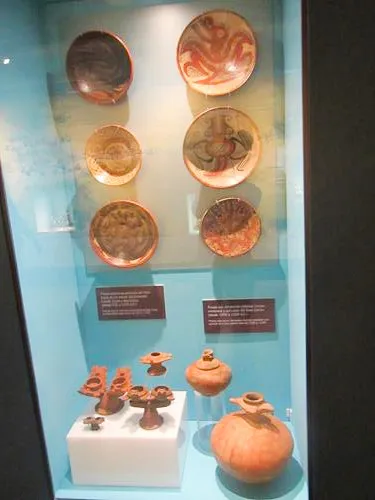
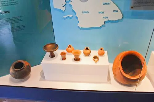
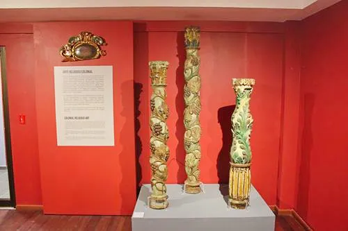
This is a small museum that explains the story of Panama Viejo in Spanish and English.

20. ESTACIONAMIENTOS JUNTO AL CONJUNTO CONVENTUAL DE SANTO DOMINGO (PARKING LOT)
PANAMA VIEJO STREETS
Panama Viejo loosely adhered to the royal instructions from 1513 which required that cities in the Americas should show a clearly ordered street design and distribution of the lots. They also laid out what the ideal places are for the Main Plaza and the main church.
In Panama Viejo, the design of the streets and the main plaza are almost squares, but no means perfect squares and the streets were also not perfectly straight or even parallel to each other and the city blocks had different sizes. Especially at the outskirts further north, streets and lots were irregular, because they followed the area’s topography.
The main streets are listed below. Please be advised that there were other streets that don’t exist anymore.
CALLE DE LA CARRERA (ROYAL ROAD)
Starting at Matadero Bridge, this was the city’s main road. I ended at the Main Plaza.
CALLE DE SANTO DOMINGO (SANTO DOMINGO ROAD)
Starting at the Main Plaza, this road went towards the Santo Domingo Convent and continued on to King’s Bridge and the Royal Road, which connected Panama City with Portobelo.
CALLE DE EMPEDRADA (PEBBLED ROAD)
Calle de Empedrada started at Main Plaza and ended at the San Francisco Convent connecting the main religious buildings in town. Empedrada is Spanish and means pebbled and, in fact, most of the road was pebbled.
CALLE DEL OBISPO (BISHOP STREET)
This road got its name, because it passed in front of where the city’s Bishop (Obispo = bishop) used to live for a long time.
BEST DESTINATIONS IN PANAMA - PANAMA Purple Travel GuideS
Which part of Panama do you want to visit next?
Author: Rudy at Backpack and Snorkel
Bio: Owner of Backpack and Snorkel Travel Guides. We create in-depth guides to help you plan unforgettable vacations around the world.

Other popular Purple Travel Guides you may be interested in:
Like this Backpack and Snorkel Purple Travel Guide? Pin these for later:
