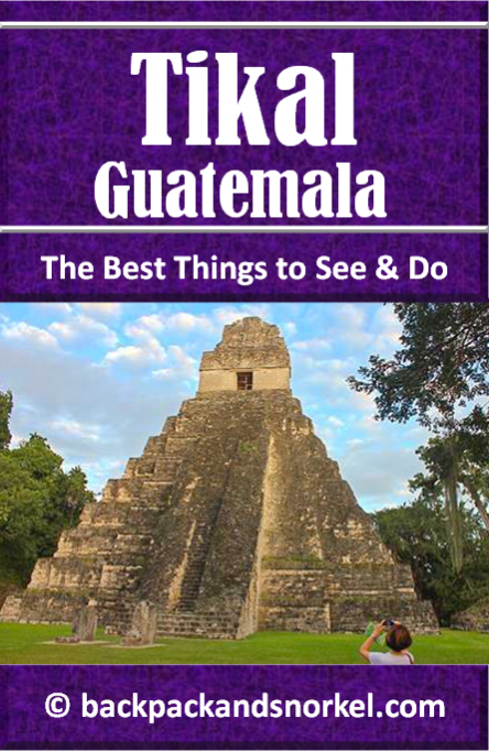
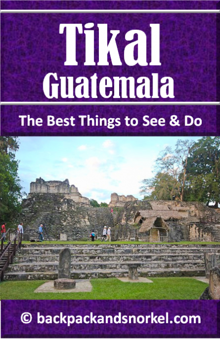
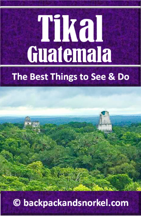
Travel Guide for Tikal in Guatemala - Tikal Purple Travel Guide
This Backpack and Snorkel Travel Guide (Tikal Purple Travel Guide) provides information about the best things to see in Tikal and it includes a self-guided walking tour of Tikal. We have added lots of photos so you know what you will see.
Overview of Tikal
Contrary to what some websites claim, you can still buy a ticket after 3:30pm that is good for same day and the next day admission. And you should definitely make use of that, because a sunset in Tikal can be magical.
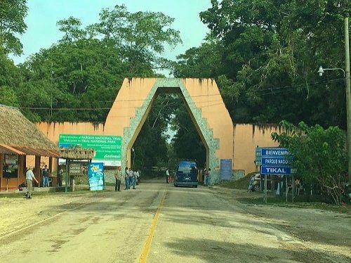
You pay admission at the first entrance gate where you need to park your car, get out and walk up some stairs to the left to get to the ticket booth.
There, you will likely be approached by tour guides that offer their services for US$60 per day. This is the same price that tour guides in the park charge.
We declined as we had tons of information about Tikal – and you do too if you use this guide. We did, however, buy the map for Q20 which is very helpful as it shows the walking paths so that you don’t get lost.
At the time when we entered the park we were advised that the speed limit was 45kph (29mph) and given an admission ticket that noted the entrance time. We drove 30-35mph and it took us about 25min to reach the main area. Yes, Tikal is huge!
At the main area, we were stopped by another guard who asked to see our ticket and he noted the arrival time. I don’t know what would have happened if we would have been speeding and had needed less than 25min.
We then parked our car in the parking lot to the right of the tour guide booth.
Then we walked back towards the tour guide booth and straight on to the gate where we had to show the admission tickets. Shortly behind the gate our tickets were checked and stamped, again.
Tikal is an amazing place! Visitors should keep in mind that all walking is on dirt roads which will get very muddy and slippery after it rains.
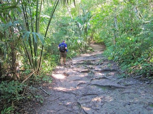
You will also need a good map to make sure that you will not get lost as there are very few maps posted in the park. So, our Q20 investment in the map paid out big time.
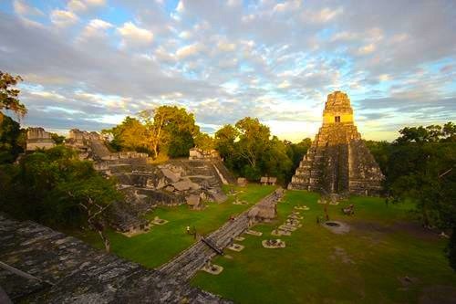
Also be aware that the temples are located far away from each other and you will likely spend the first 20-30min just walking to temples 1 and 2. As a matter of fact, you will spend a significant time of your visit walking between the sights. There are only 2 tall temples that you are allowed to climb and several smaller structures. Both tall temples have wooden steps and handrails installed at the side.
Bring enough water and food as there are limited opportunities to buy food and drinks. Also bring rain gear as there are not too many opportunities to hide from a thunderstorm.
Everyone who plans to experience sunset or sunrise at Tikal and stay outside the park should be warned, there will be plenty of people (dressed in dark clothes) walking or riding unlighted bicycles on the streets after dark and there will be the occasional animal on the road. You may only see them when you are a few feet away and have very little time to react. Thus driving at night can be real dangerous.
Luckily, you can stay inside the park. There are three options to stay inside the park:
Jungle Lodge Hotel & Hostel
Hotel Jaguar Inn Tikal
Hotel Tikal Inn
We stayed outside the park in a nice local hotel, Hotel Las Gardenias. Many people stay in Flores which is 41 miles (65km) from Tikal.
Long story short: Tikal is a fascinating and very spread-out Mayan site that is definitely worth a visit. I advise to either hire a tour guide or use this guide for a self-guided experience. You can, of course, also buy a book about Tikal for even more detailed information. Just be aware that there are almost no descriptions of what you see inside the park.
History of Tikal
Tikal was the capital of one of the most powerful kingdoms of the ancient Maya culture. It was likely called “Yax Mutal” or “Yax Mutul” with Yax meaning “first” and “Mutul” being the name of the kingdom.
The name Tikal was given to the site after it was discovered in the 1840s and Tikal may mean "at the waterhole" after one of the waterholes here or "the place of the voices".
Tikal consists of approx. 3,000 structures and covers an area of about 6 square miles (16km2). At its peak, the population may have been as high as 90,000. The population within a radius of 16 miles (25km) could have been as high as 425,000. This number is, however, disputed.
Tikal is believed to have been most powerful from 200AD to 900AD when the city was the dominant religious, political, economical, and military force in the Maya kingdom.
There is archeological evidence for agricultural use of this site dating back to 1,000BC.
The earliest large construction dates back to 400-300BC with the appearance of major pyramids and platforms. At that time, Tikal was still a small city.
When its northern neighboring cities El Mirador and Nakbe collapsed at around 100AD, Tikal started growing in importance.
The first dynasty of rulers at Tikal started at around 90AD.
The following table shows the rulers of Tikal:
Name (or nickname) |
Ruled |
Ruler |
Alternative names |
Yax Ehb' Xook |
ca. 90 |
1 |
Yax Moch Xok, Yax Chakte'l Xok, First Scaffold Shark |
Foliated Jaguar |
ca. 292 |
? |
- |
Animal Headdress |
? |
10? |
Kinich Ehb'? |
Sihyaj Chan K'awiil I |
ca. 307 |
11 |
- |
Unen Bahlam |
ca. 317 |
12? |
- |
K'inich Muwaan Jol I |
? –359 |
13 |
Mahk'ina Bird Skull, Feather Skull |
Chak Tok Ich'aak I |
360–378 |
14 |
Jaguar Paw, Great Paw, Great Jaguar Paw |
Yax Nuun Ayiin I |
379 –404? |
15 |
Curl Snout, Curl Nose |
Sihyaj Chan K'awiil II |
411–456 |
16 |
Stormy Sky, Manikin Cleft Sky |
K'an Chitam |
458–ca. 486 |
17 |
Kan Boar, K'an Ak |
Chak Tok Ich'aak II |
ca. 486–508 |
18 |
Jaguar Paw II, Jaguar Paw Skull |
Lady of Tikal |
ca. 511–527+ |
19 |
Curl Head |
? |
? |
20? |
Animal Skull I |
Wak Chan K'awiil |
537?–562 |
21 |
Double Bird |
Animal Skull |
ca. 593–628 |
22 |
- |
K'inich Muwaan Jol II |
ca. 628–650 |
23 or 24 |
- |
Nuun Ujol Chaak |
ca. 650–679 |
25 |
Shield Skull, Nun Bak Chak |
Jasaw Chan K'awiil I |
682–734 |
26 |
Ruler A, Ah Cacao |
Yik'in Chan K'awiil |
734–ca. 766 |
27 |
Ruler B, Yaxkin Caan Chac, Sun Sky Rain |
Ruler 28 |
ca. 766–768 |
28 |
- |
Yax Nuun Ayiin II |
768–ca. 794 |
29 |
- |
Nuun Ujol K'inich |
ca. 800? |
30? |
- |
Dark Sun |
–810+ |
31? |
- |
Jewel K'awiil |
–849+ |
? |
- |
Jasaw Chan K'awiil II |
–869+ |
? |
- |
As early as 200AD, Teotihuacan (the largest and one of the most powerful cities in the pre-Columbian Americas, located near today’s Mexico City) had embassies in Tikal. It appears that in 378AD, Tikal was invaded by Teotihuacan and the ruling king killed and replaced by a Teotihuacan king. This led to a powerful alliance between both cities until the 7th century.
In the 6th century, a long running rivalry between Tikal and its neighbor to the north Calakmul began which led to three wars between 537–744AD.
In the first war from 537–572AD Calakmul formed alliances with Caracol, El Perú and El Zotz who eventually defeated Tikal. Tikal was not destroyed, but declined for several decades. This is called the “Tikal hiatus” during which nearly no new inscriptions or large-scale construction took place at Tikal.
Over time, Tikal slowly regained strength while El Zotz declined and a cold war with minor skirmishes but no major battles followed.
The second war erupted from 650–695AD after Calakmul had overrun Dos Pilas, a military outpost established by Tikal in 629AD. The ruler of Dos Pilas was the brother of Tikal’s king. After initially fleeing, he was captured and instead of being executed he was reinstated under Calakmul’s rule. He then defeated Tikal in 657AD and dominated the city. In the following years, forces loyal to the Tikal king retook Dos Pilas and other cities and the ruler from Tikal rebuilt his following. But it took until 695AD until Tikal defeated Calakmul and ended the second war. Occasional violence continued, however.
The third war took place from 720–744AD. It started when Quiriguá (a city promoted by Tikal and its close ally Copán) declared independence from Copán in 734AD, which led to a 4-year independence war during which, in 736AD, Quiriguá and Calakmul formed an alliance. It ended with Quiriguá’s independence in 738AD, when the ruler of Copán was captured by Quiriguá, trialed and then executed. Tikal then conquered El Peru in 743AD and Naranjo in 744AD, which destroyed Calakmul’s powerful network of allies. Calakmul eventually lost its northern provinces to nations on the Yucatán Peninsula and its last recorded date was 899, possibly 909.
Calakmul’s eventual abandonment was part of the Maya Collapse which eventually led to Tikal’s downfall less than 100 years later.
In 810AD, major construction in Tikal was still going on and by 830AD no activity is seen anymore and Tikal fell silent. The last construction of a monument happened in 869AD. Between 830 and 950AD, Tikal seems to have lost most of its population, its satellite sites became independent and other cities inherited part of Tikal’s former power. It appears that the central authority collapsed and there is evidence that palaces were burned. Royal palaces were abandoned by the ruling class and then occupied by commoners and simple thatched houses were erected in the ceremonial plazas. Tombs were looted, some monuments were vandalized, and others were moved to different locations.
There is also evidence of deforestation, soil erosion and nutrient loss and contaminated water sources.
Tikal was abandoned by 950, maybe with the exception of a few people. But those vanished at the latest in the 10th or 11th century and Tikal was claimed by the rainforest until it was rediscovered in the 1840s.
The fall of Tikal may have partly been caused by droughts and partly by using poisonous chemicals like mercury containing paint which washed off the buildings and contaminated the ground water.
In 1525, Spanish conquistador Hernán Cortés passed only a few miles away without discovering the ruins. In 1696, a Spanish friar got lost in the forest and described a ruin that may have been Tikal.
Throughout history, rumors of Tikal surfaced, but the area was too remote for anyone to seriously consider coming here.
The site was then visited in 1848 for the first time and the first excavation began in 1881. A small airstrip was built in 1951 to make it easier for archeologists to reach the site. From 1956 through 1970, major archaeological excavations were carried out by the Tikal Project team of the University of Pennsylvania. Further excavations then took place from 1979 to 184.
Structures of Tikal
What you see today is only a small part of the original city. Tikal probably covered an area of about 48 square miles (125km2) and, at the perimeter of some areas, a 20ft (6m) wide trench behind a rampart was found. It may have been built as a defense against invading armies.
The residential area inside was about 23 square miles (60km2) while the central area that you can visit today covers about 6 square miles (16km2).
Tikal’s buildings can be divided into the major temples and different building groups:
Connecting these groups were several causeways (raised paved roads):
Maler Causeway
It connects Temple I and Group H. South of Group H is a large relief that is carved onto the limestone bedrock which depicts two bound captives.Maudsley Causeway
It connects Temple IV and Group H. and is 0.5 miles (0.8km) long.Mendez Causeway
It is 0.8 miles (1.3km) long and connects East Plaza and Temple VI.Tozzer Causeway
It connects the Great Plaza and Temple IV.
What do you want to explore now?


Author: Rudy at Backpack and Snorkel
Bio: Owner of Backpack and Snorkel Travel Guides. We create in-depth guides to help you plan unforgettable vacations around the world.

Other popular Purple Travel Guides you may be interested in:
Like this Backpack and Snorkel Purple Travel Guide? Pin these for later: