Travel Guide for WHITE OAK PARK - Pittsburgh Purple Travel Guide
We tell you why you should visit WHITE OAK PARK in the Pittsburgh area and what you need to know.
White Oak Park is an Allegheny County Park. If you plan on hiking here, I recommend downloading the Allegheny County Parks app and, within the app, downloading the map of this park for offline use.
Even though the app hangs at times and may need to be restarted, it shows you all the blazed trails and its GPS function shows you exactly where you are on the trail. The website with interactive maps, PDF maps and links to the app is here.
The PDF map of the park, states that the park has no blazed trails. This is not correct. The park has one blazed trail with the white blaze symbol and this trail is only shown in part on the map.
If you use the Allegheny County Parks app, it will show the trail almost correctly, but misses one important turn. My description below will tell you exactly how to hike the trail.
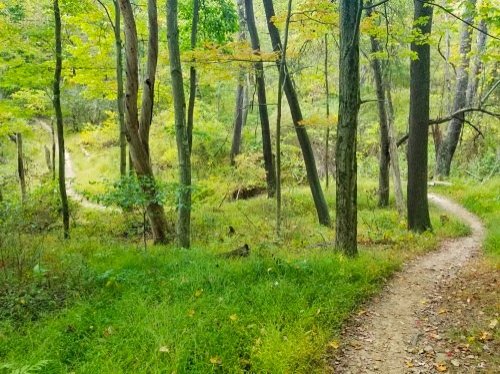
The white blazed trail is a 2.5 mile moderately difficult trail that is nice to hike. You will absolutely need the Allegheny County Parks app as there are quite a few unmarked trails and trail crossings and it can be difficult to find the correct way without the app as the white blaze symbols are sometimes difficult to find.
Park your car at the "Wedding Garden" parking lot (map) which is marked in yellow on the map below.
Then walk down to the grassy area. The trailhead is hidden approximately in the middle of the grassy area.

For the first half mile, the trail is easy to follow and there are few white blaze symbols. Afterwards, you will find quite a few forks in the trail and you will need the Allegheny County parks app to find the correct trail. When you cross the road after approx. 1.6 miles, make sure to take the trail in the forest and do not go up the dirt road or the grassy area.
Towards the end of the trail, there is another fork and, contrary to what the app tells you, you go right up the hill (I marked this in red in the map below). This is the white blazed trail even though the park app shows this as an unblazed side trail. Go up the hill and you will end at the fence of the dog park. This is where the trail ends.
Now comes what I marked purple on the map below: Make a left and walk around the fence, then go up the hill to the parking lot, cross it and keep walking to 11 o’clock (forward, forward left, like on the old analog watches). You go downhill on a grassy areas and when you hit the next street, you can see the blue roof shelter behind the trees to your left. This is the shelter that you may have seen at the entrance to the “Wedding Garden” parking lot. There is no need to go to the shelter. Just cross the street and keep walking down the hill to the parking lot where your car waits for you.


Back to the Best Parks & Trails in Pittsburgh
Author: Rudy at Backpack and Snorkel
Bio: Owner of Backpack and Snorkel Travel Guides. We create in-depth guides to help you plan unforgettable vacations around the world.
Other popular Purple Travel Guides you may be interested in:
Like this Backpack and Snorkel Purple Travel Guide? Pin these for later:


