Self-guided walking tour from Ville Haute to Fort Thüngen in Luxembourg City - Luxembourg Purple Travel Guide
Today’s self-guided walking tour requires about 3.4 miles (5.4 km) of walking, which does not include walking in the museums and casemates.

Here at Backpack and Snorkel Travel Guides, we typically promote self-guided walking tours.
But we realize that not everybody likes to walk by themselves in a foreign city. So, just in case that you rather go with ab guide: NO PROBLEM! Please see the free GuruWalk and paid Viator tours below.
free GuruWalk tours
paid Viator tours
General Information about Luxembourg |
Self-guided walking tour of Ville-Haute in Luxembourg City |
>Self-guided walking tour from Ville Haute to Fort Thüngen in Luxembourg City |
Self-guided tour of Vianden Castle and Echternach in Luxembourg |
Musée national d'histoire et d'art Luxembourg
At the time of writing, the museum is open from Tuesday through Sunday from 10am – 6pm (Thursday 8pm)
Admission for the Permanent Exhibition: free
Admission for the Temporary Exhibitions: 7 € per adult
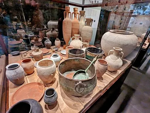
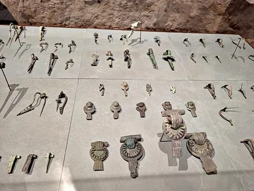
The National Museum of History and Art is dedicated to displaying artworks and artefacts from Luxembourg’s entire history.
The history of the National Museum of History and Art begins in 1845 with the founding of the 'Society for the Study and Preservation of Historic Monuments in the Grand Duchy of Luxembourg' which was responsible for maintaining a collection of historic antiquities from Luxembourg City. In 1868, it was merged into the Grand Ducal Institute with additional responsibilities including the conservation of archaeological collections.
In 1939, at the beginning of World War II, the museum moved its collections to secure them. After the war, in 1946, the museum reopened as the Luxembourg State Museums and its collections were moved back.
In 1988, the museum was separated into the National Museum of History and Art and the National Museum of Natural History, which moved to a new building in 1996.
The museum is located on 5 different floors, starting with Prehistoric Times on the lowest underground floor. On higher floors, there are exhibits from Bronze Times, Roman Times and, on the highest floor, contemporary times.
We found the collections to be worthwhile and educational. All exhibits had French descriptions, many had German descriptions and only very few had English descriptions.
At the entrance of each floor are laminated booklets in English that provide additional information.
But they don’t replace the need for the audio guide that you get at the entrance. The audio guide has lots of information which, in my opinion, was often too detailed and time consuming.
No bags or backpacks are allowed in the museum. They have lockers where you can lock your belongings for €1. The Euro is refunded when you open the locker.


Saint-Michel Church
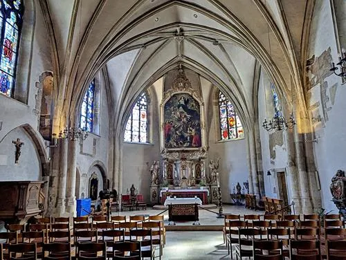
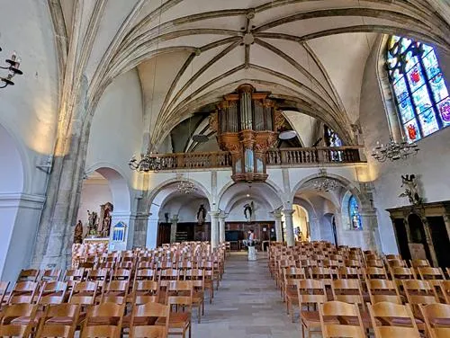
Saint Michael's Church (Luxembourgish: Méchelskierch, French: French: Église Saint-Michel) is a Roman Catholic church and the oldest still operating religious site in Luxembourg City.
The first church was built in 987 as a castle chapel for the Count of Luxembourg. It was later destroyed, rebuilt, and underwent several renovations.
The church you see today, in Romanesque and Baroque architectural styles, dates back to 1688.


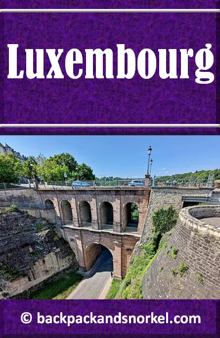
Pont du Château Bridge / Castel Bridge
This two-story bridge was built in 1735 out of red sandstone, replacing a wooden construction with a drawbridge. It connects Ville-Haute with the Bock Promontory. It was completely restored from 1992 - 1993.
Interestingly, the bridge allows four distinct ways to cross it:
the road on top
a passage through the four upper arches
a spiral staircase through the main arch
a tunnel under the road at the bottom.
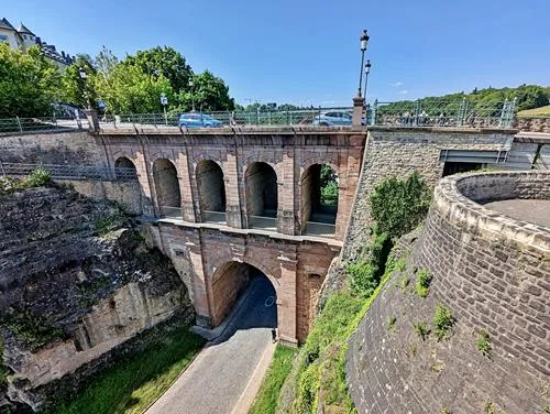

Walk to the Pont du Château Bridge and explore the Crypte Archéologique (Archaeological Crypt) on the right side and the Huelen Zant ruin a bit further down the bridge on the left.
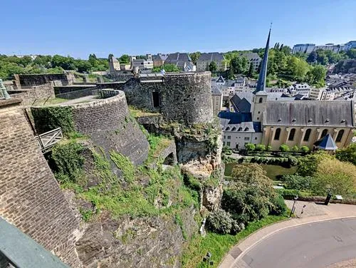
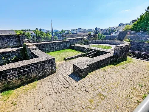
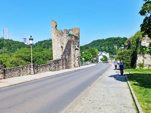
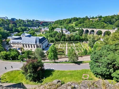
Last but not least, enjoy the fantastic views from the bridge.
Bock Casemates
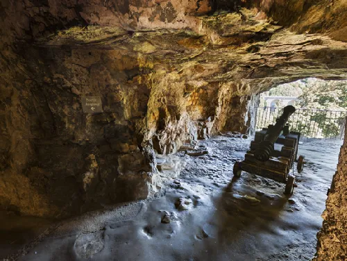
The Pétrusse Casemates and Bock Casemates are medieval fortifications that were built into the hillside side of the Bock Rock on which historical Luxembourg City is built.
There is no need to see the Pétrusse Casemates and the Bock Casemates – you can decide which one you are more interested in seeing.
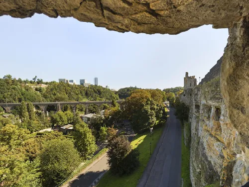
The Bock Casemates are advertised as ‘Rock with a view’. This is, because you have wonderful views of the valley from several of the openings in the walls. Since you can walk on top of the Bock Casemates, you have a very similar view from there, too. Otherwise, the Bock and Pétrusse Casemates are fairly similar.
Admission to the Bock Casemates is every 15 min from 10am to 6pm (last admission at 5pm) for self-guided tours. You will need approx. 45min. make sure to arrive at the time printed on your ticket as you may be denied entry if you come outside your 15min window.
At the time of writing, tickets cost €8 per adult and discounts are available for children, seniors, and students. Since the Bock Casemates are the more popular of the two publicly accessible casemates, it is recommended to buy tickets online.
The first casemates in Luxembourg City were built in 1644 by the Spanish in their effort to improve the fortifications of the city.
In 1745, the Austrians built what is today known as the Bock Casemates, which were 360 ft (110 m) long and 23 ft (7 m) wide.
At their peak, there were 14 miles (23 km) of casemates on multiple levels, up to 131 ft (40 m) deep.
The Bock Casemates held up to 1.200 soldiers and 50 canons.
After the Treaty of London in 1867, Luxembourg’s fortifications were largely dismantled and most of the entrances to the casemates were bricked up and about 3.7 miles (6 km) of the casemates were destroyed.
In the 19th century, the remaining casemates were used as storage for local companies, shooting ranges and to grow mushrooms and in the early 20th century, concerts and bazaars were held here.
During both world wars, the Bock and Pétrusse casemates were used as shelters. Your tour guide of the Pétrusse Casemates will point this out to you.
The fortifications of the city of Luxembourg and its old quarters were added to the UNESCO World Heritage list in 1994.


Porte des Trois Tours / The Three Towers
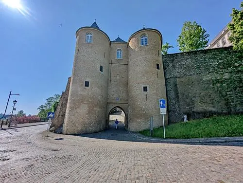
The medieval gate called "the Three Towers" consists of two round towers from the 14th century and a central square dwelling of the 12th century. The central part belonged to the first medieval stone enclosure.
Until 1810, the Three Towers Gate served as a gateway to the Ville-Haute and a prison.
Old writings mention dungeons underground and ropes to get the prisoners down and up.
Behind the medieval gate was a small bastion that was built in 1606 to watch and protect the surroundings of the gate. It was transformed into the palace garden terrace in 1828.

Spanish Turret / Spanish Watch Tower
A series of watchtowers (perhaps up to 37) were built by the Spaniards in the 17th century as part of major fortification work. The purpose of the turrets has not been clearly established. Some have survived until today.

Now go back to where you came from for about 600 ft (185 m) until the road makes a left turn. This is where Chemin de la Corniche starts.
Chemin de la Corniche
A ‘corniche’ is a road or walkway which is built into the side of the mountain, where the terrain steeply rises on one side and falls on the other.
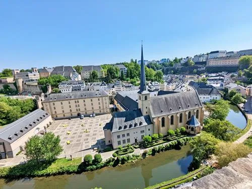
The Chemin de la Corniche was built along the sides of the Bock, and it offers wonderful views of the Alzette Valley and The Grund (the part of town in the valley). The views earned Chemin de la Corniche the nickname ‘the most beautiful balcony in Europe ‘. It starts near St. Michael's Church, then winds along the Bock southwards and ends at the road ‘Mnt du Grund’ in the valley below the National Archives building. Be advised that, towards the end, the Chemin makes an almost 180 degree turn to the left and then goes downhill. The total length is approx. 1,650 ft (500 m).

The Grund towards Viaduc Ferroviaire / Viaduc de Pfaffenthal
When you come to 'Mnt du Grund', turn right (do not go through the Porte espagnole (Grund) / Spanish (Grund) Gate). After 420 ft (125 m), make a left on Rue Sosthène Weis and follow it for approx. 1,150 ft (350 m) through the Pont du Château Bridge.
Shortly behind the bridge at the crosswalk, make a right and then follow Rue du Fort Olisy, which will bring you to Viaduc Ferroviaire / Viaduc de Pfaffenthal after about 650 ft (200 m).
The Pfaffenthal viaduct is an 843 ft (257 m) long railway bridge that crosses the Alzette valley. It was opened for rail traffic in 1862.


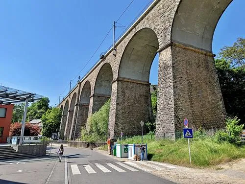

Keep walking and cross the small bridge that crosses the Alzette river. At the intersection, turn left and walk for about 1,000 ft (310 m). Then take Rue des Trois-Glands that branches off to the right and your next destination will be ahead after 400 ft (120 m).
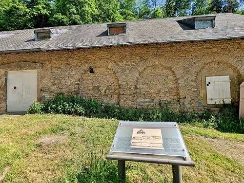
La Hiel Flour Store House
This is just a waypoint to the hiking path to Fort Thüngen. Unfortunately, you cannot enter the building.
Built in 1733, the building was designed to securely store flour away from bugs and mice so that there was enough available in case a foreign army was going to besiege the city.
In 1771, the exterior walls, except for the front wall, were upgraded to brick walls with arcades. It is estimated that the front side was upgraded to bricks at some point between 1815 and 1866.
Hike to Fort Obergrünewald
Approx. 160 ft (50 m) after you pass the building, you will see a hiking trail branching off to the sharp right. Follow this trail up the hill.
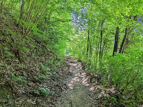
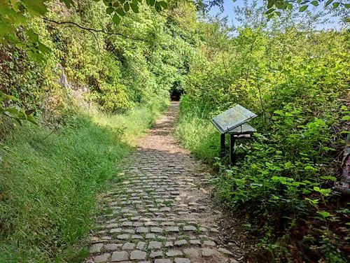
The trail will split a few times, and it is important that you follow the signs with the red logo and the ‘itinéraire Vauban’ text.
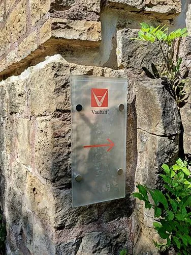
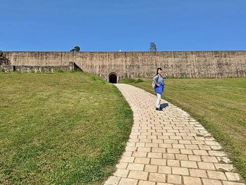
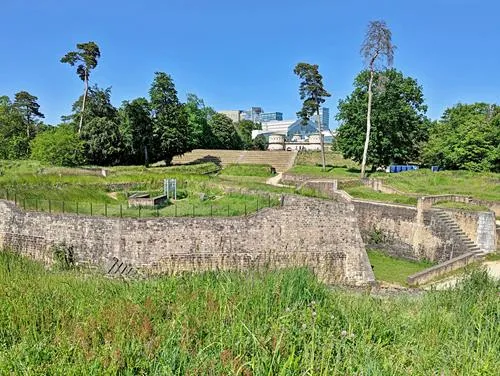
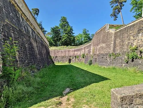
After approx. 700 ft (200 m), you will come to the ruins of Fort Obergrünewald.
After Luxembourg City was captured by the French in 1684, Vauban, the French military engineer who is considered the greatest engineer of his time, redesigned and reinforced an existing fortifications in 1684. He expanded defensive walls throughout the Pfaffenthal and all the way to the Bock, fortified the heights of Grünewald and, added a redoubt in 1688.
The Austrians took possession of the fortress in 1716 and named the horn work of the bastion Fort Obergrünewald. When Fort Thüngen was constructed, an underground was built to Fort Obergrünewald.
In 1872, the dismantling of the fort began with the demolition of the powder magazine; the redoubt and the gorge wall were destroyed in 1874.
When you get into the fort, make sure to take on of the stairs to the top for good views of the fort and the valley.

Fort Thüngen
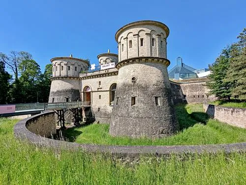
Continue up the hill and you will get to Fort Thüngen after approx. 330 ft (100 m). The fort has the nickname ‘Three Acorns’, because there is one acorn on top of each tower.
The fort was built in 1732-1733 and enlarged and reinforced by the Prussians in 1836 and from 1859 – 1860.
Most of Fort Thüngen was demolished as the 1867 Treaty of London required. Only the three towers and the foundations of the rest of the fort remained.
The intact fort that you see today is a reconstruction which reflects the last phase of the original expansion in 1837. The work was finished, and the fort was reopened as the Musée Dräi Eechelen (Three Acorns Museum).
At the time of writing, opening hours are Tuesdays through Sundays from 10am – 6pm (Wednesdays 8pm) and admission is free.
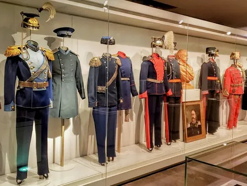
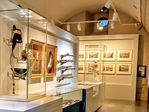
The permanent exhibition has about 600 artefacts which cover the history of Luxembourg from the Burgundian conquest in 1443 to the construction of the Adolphe Bridge in 1903. The exhibits are displayed in several casemates (underground galleries).
With its underground galleries, the building itself becomes an important part of the permanent exhibition. It has been restored to reflect the last phase of its original expansion in 1837.

INFINITY Shopping Center / Place de Village Kirchberg
When you exit Fort Thüngen, make a right and follow the path along the side of the fort and then to the back of MUDAM (Grand Duke Jean Museum of Modern Art). At the back, you will see the parking lot of the European Parliament (Schuman Building). Walk through the parking lot until you reach the busy Avenue John F. Kennedy. Cross the street and you will come to the INFINITY Shopping Center. After such a long walk, you deserve to relax in one of the cafes or restaurants or you can do some shopping.
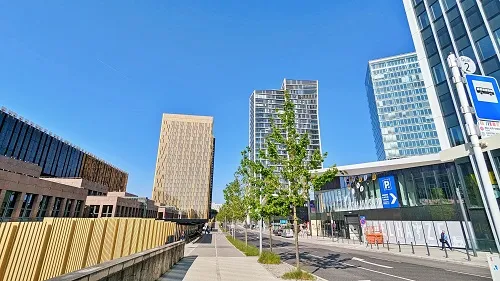
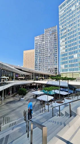
When you are done, you can either take the free tram (T1) or free bus (12, 32, CN4) back into town. The tram station is directly in front of the building (where you crossed the road earlier) and there is a bus stop in the street ‘Rue du Fort Niedergruenewald’, which is the street that branches off near the tram station.
Here are our recommendations as to the station where you should exit the tram/bus to continue your tour:
T1: exit at Limpertsberg, Theater
12: exit at Centre, Fondation Pescatore
32: exit at Centre, Fondation Pescatore
CN4: exit at Centre, Fondation Pescatore
Parc Fondation Pescatore
Parc Fondation Pescatore is a nice, relaxed park which covers approx. 3.8 acres (15,200 m2). The walking paths are asphalt, and it has benches, a fountain, and some pieces of art. To the north, behind a gate, is ‘Pescatore, J.P. Foundation’, a senior citizen center which is housed in a beautiful neo-gothic building that was built in 1886.
The foundation goes back to Luxembourg merchant and banker Jean-Pierre Pescatore who left the city 500,000 Francs and his prestigious art collection under the condition that they found a social institution and museum. The result is the building and the park.
During the Battle of the Bulge (Ardennes Offensive in 1944/1945), the building was used as the headquarters of the US General George S. Patton.
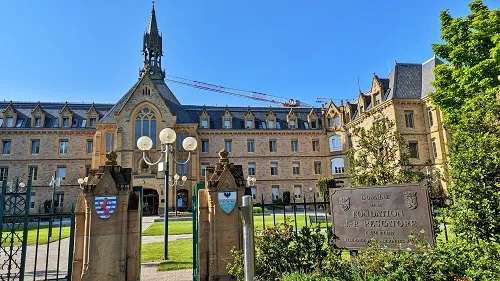

This park is right near our last attraction for today, the Pfaffenthal Panoramic Elevator.
Pfaffenthal Panoramic Elevator
The Pfaffenthal Panoramic Elevator connects Luxembourg City’s historic downtown (Ville-Haute) with Pfaffenthal in the Alzette River Valley.
The elevator is operational every day from 5.45am – 1am, except every first Monday of the month after 9am, when it is down for maintenance.
There is no admission fee, no operator, and there is usually no significant wait to use the elevator.
The idea to build a connection between Luxembourg City’s historic center (Ville-Haute) and the Alzette River Valley dates back to 2006, when the city was exploring means to facilitate pedestrian and bicycle traffic between the two parts of the city for locals and tourists alike.
Various options were explored, including aerial cable cars, an elevator, escalators, and a funicular. In 2007, the decision was made to build an elevator, due to cost and esthetic reasons. Groundbreaking was in 2009, but construction was delayed by four years due to geological issues as the hillside had to be stabilized for this project. Construction was done in 2015, the elevator cabin installed in 2016 and the official inauguration ceremony was held the same year.
The main vertical structure consists of a 245 ft (75 m) tall, 8.5 ft (2.6 m) wide and 8.5 ft (2.6 m) deep hollow tower constructed out of reinforced concrete, which contains the elevator counterweight.
The valley-facing side of the tower acts as the backing for the 197 ft (60 m) tall elevator shaft, open on its face and nearly completely open on its sides.
To stabilize the terrain, the excavated hillside is covered with sprayed concrete and secured by 72 anchor bolts which are driven as far as 98 ft (30 m) deep into the hillside, with a 52 ft (16 m) high reinforced concrete retaining wall at its base.
The bridge to the elevator and the elevator cabin have glass walls and allow for fantastic views of the valley.

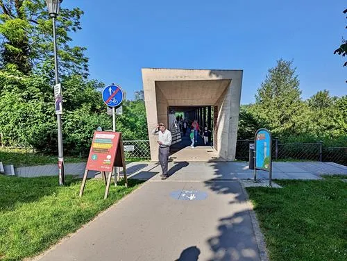
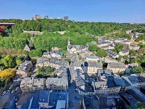
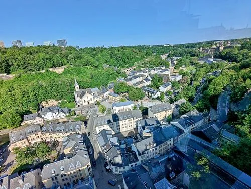
This concludes day 2 of your Luxembourg City self-guided walking tour.
Where do you want to go now?
Author: Rudy at Backpack and Snorkel
Bio: Owner of Backpack and Snorkel Travel Guides. We create in-depth guides to help you plan unforgettable vacations around the world.
Other popular Purple Travel Guides you may be interested in:
Like this Backpack and Snorkel Purple Travel Guide? Pin these for later:

