Travel Guide for self-driving the Golden Circle in Iceland - Iceland Purple Travel Guide
This Backpack and Snorkel Iceland Travel Guide provides a detailed itinerary for Self-Driving the Golden Circle in Iceland so that you can make memorable moments on a relaxing vacation in Iceland.
For more detailed information incl. links to google maps locations, more reviews, website links, etc., check out our Iceland Highlights Purple Travel Guide.
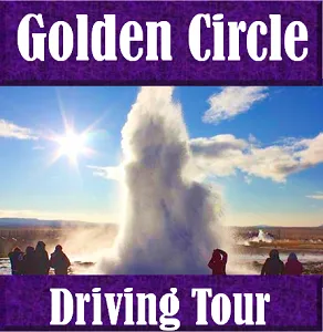
SELF-GUIDED GOLDEN CIRCLE TOUR
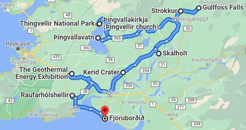
One of the first things people will tell you to do in Iceland is the Golden Circle Tour. It is one of the major tourist attractions in Iceland for a good reason as the Golden Circle connects 3 major sites close to Reykjavik: The Þingvellir National Park, the Geysir Geothermal Area, and the Gullfoss waterfall.
Besides those 3 major attractions, there are many other sites worth seeing. Some tours will include most or all of these additional sites and others may only bring you to the 3 major stops.
Most people decide to do the Golden Circle tour in one day and this is absolutely doable. Just rent a car and start driving. The roads are in excellent condition and there are so few roads that it is difficult to get lost. Driving the Golden Circle in a regular sedan is fine; the roads are paved and in good condition. Alternatively, you can join a guided tour.
Start your Self-Guided Golden Circle Tour in the morning so that you have enough time to see all attractions. The map below shows you the individual destinations; if you click on the map, then you will be taken to google maps with more details.
The first destination, Thingvellir National Park, lies about 40min to the north east of Reykjavik.
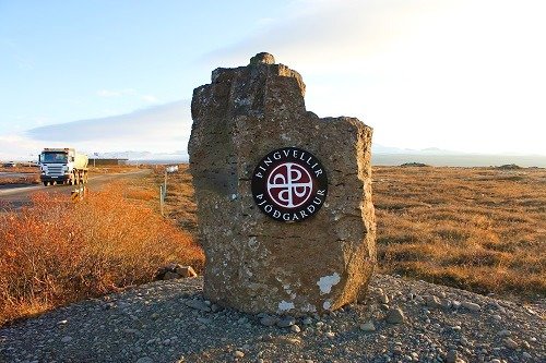
THINGVELLIR NATIONAL PARK
Þingvellir National Park is a UNESCO World Heritage site. It is associated with the ancient national parliament of Iceland, the Althing, which was established here in 930AD. Þingvellir National Park was established 1,000 years later in 1930 to celebrate this event.
The name Þingvellir comes from an old Norse word meaning "assembly fields" with þing meaning "assembly” and vellir meaning “field”.
The settlement of Iceland began in 874AD and the Norwegian chieftain Ingólfr Arnarson was the first permanent settler on the island. Over time, the population grew and Ingólfr Arnarson's descendants became the most influential and powerful family. To limit their power, other chieftains convinced them to establish a general assembly and a search for a suitable location was started.
Coincidently at almost the same time, the owner of what is now Þingvellir was found guilty of murder and his land declared public. Because the land was available, easily accessibility, the surrounding cliffs provided a natural amphitheater, the lake provided water and fish and the grassy landscape provided grazing grounds for horses and allowed to build encampments, this location was chosen.
As the first parliamentary proceedings in the summer of 930AD laid the groundwork for a common cultural heritage and national identity of Iceland, these events are seen as the foundation of the Icelandic parliament.
From 930AD to 1271, the Alþingi (parliament) at Þingvellir was Iceland's highest legislative and judicial authority, its parliament and supreme court. It became the center of Icelandic culture and every year sometimes thousands of people would travel to Þingvellir for the 2 weeks the Alþingi was in session. They would set up temporary buildings as there were no permanent buildings over here at that time, besides a farm and later on two churches.
Besides the people involved in the assembly, ordinary people like merchants, artists, entertainers and craftsmen who would sell their goods and services, gathered here. There were apparently even ale makers who brewed beer. As Þingvellir was a meeting place for everyone in Iceland, it laid the foundation for a common language, law, and culture and made everyone feel of being part of the same nation.
Over time, however, power hungry chieftains and other disputes resulted in warfare and eventually brought weakened Iceland under Norwegian rule. The legislative and judicial authority remained with the Alþingi at first, but was slowly transferred to the Norwegian and later Danish crown. The Althing held its last session at Þingvellir in 1800, after which it was discontinued. In 1844 the Althing was restored in Reykjavík, where it is located until today in the Alþingishús.
Because the Althing is back in existence today, it is considered the oldest surviving parliament in the world.
Drive to the parking lot by the interpretive center and walk to the overview for a beautiful view of the valley and the Flosagjá fault and the Öxará (Axe) river. You can hike down towards the church and back to the parking lot or drive to the church later on this self-guided tour.
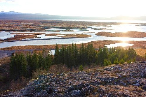
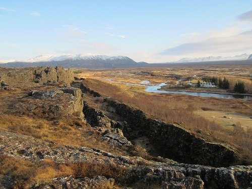
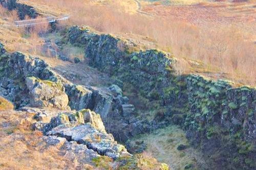
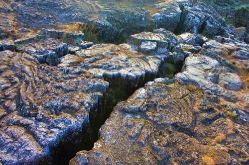
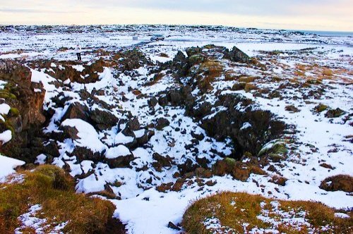
Þingvellir National Park is also a place where cracks in the earth's surface are silent witnesses of the continental drift between the North American and Eurasian plates. The largest crack (fault) is Almannagjá, which is actually a canyon. The tectonic plates keep moving and result in Iceland growing by 0.8in (2cm) per year. As a result of the movement, you may feel small earthquakes every now and then.
Some of the faults have filled up with water over time. The water is so clear that you can snorkel and dive in them. The Silfra fissure is probably the best known snorkeling and diving site. Diving tours are operated by BlueWater Travel. We just find it amazing to know that you can dive between the tectonic plates of North America and the Europe.
It was too cold when we were there, but if you feel like it, go ahead and join a guided snorkeling tour and let us know how it was.
Another fissure, Nikulásargjá, is known as the "coin fissure". It started when King Frederick VIII of Denmark was visiting in 1907 and visitors began throwing coins from the bridge that was built for the king.
When you are done exploring this site, get back to your car and head East on route 36 towards Geysir, drive until you hit route 361 and make a right turn on this road until you get to the church that you saw from the viewpoint. Get out of the car and visit the church and enjoy the cliffs with the waterfall and the scenery in general.
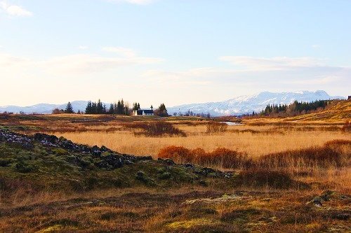
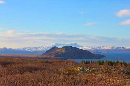
LAKE ÞINGVALLAVATN
When you are done exploring this site, get back to your car and route 36 and head East towards Geysir. You will soon see beautiful lake Þingvallavatn. Keep driving and turn on route 365 to get to Geysir and the route 37 and 35. Don't worry, there are signs directing you where to go. Just make sure you don't miss them because your eyes are glued to the beautiful scenery that you are passing through.
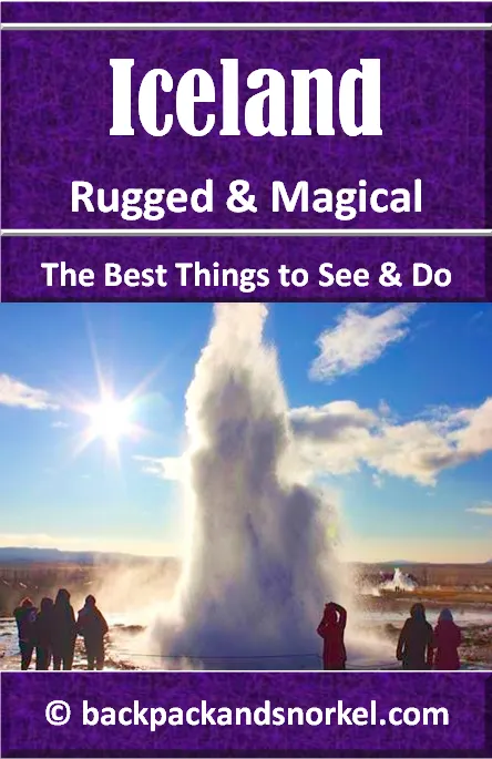
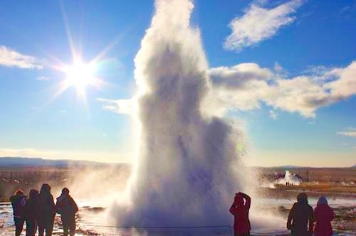
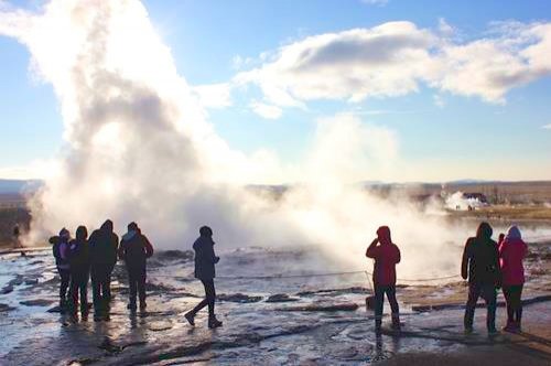
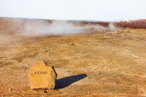
THE GREAT GEYSIR AND STROKKUR
The Haukadalur geothermal area is home of Iceland's most famous geyser, Strokkur ("churn"), The Great Geysir and other geothermal features like mud pots, hot springs, and fumaroles.
While the Haukadalur geothermal area is active for approx. 10,000 years, hot springs were only reported after a series of earthquakes in 1294.
The word Geysir was first mentioned in the 18th century; its origin lies in the Old Norse verb "geysa" which means "to gush".
It is said that the Great Geysir reached a height of 560ft (170m) in 1845. In 1846, however, Robert Bunsen was researching Geysir and he reported eruptions of 148-177ft (45-54m) and he is credited with understanding how the geyser works.
Over time, earthquakes and man-made activity like digging ditches and adding soap have led to the Great Geysir changing its activity and in 1916 its activity stopped completely.
Nearby Stokkur is much more active and erupts every 5-10min while The Great Geysir rarely erupts anymore.
Stokkur is much younger; it was created through an earthquake in 1789. Like Geysir, it has had more and less active periods. It is said that its eruptions in 1815 reached 200ft (60m), which is 3 times higher compared to its height these days. At the turn of the 20th century, another earthquake blocked the conduit and eruptions ceased until locals cleaned out the blocked conduit in 1963.

The next highlight on your trip is Gullfoss which lies about 10min to the east on route 35.
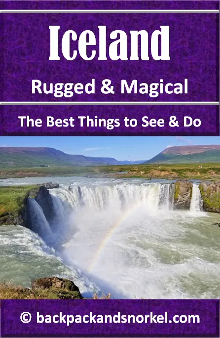
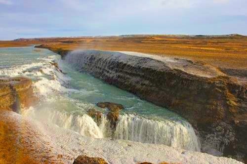
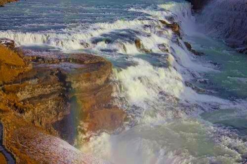
GULLFOSS WATERFALL
When you visit Gullfoss, consider yourself lucky that you can see the waterfall in all its natural beauty. In the early 20th century, there were plans to use Gullfoss to generate electricity. Luckily, the investors were unable to secure enough funds to realize the project and the waterfall was eventually sold to the government which then turned it into a protected area.
A likely untrue story is that Sigríður Tómasdóttir, the daughter of Tómas Tómasson, threatened to throw herself down the falls in order to save Gullfoss from development. She did a lot of other things to preserve the falls and a stone memorial above the falls commemorates her and her efforts.
The Gullfoss waterfall is formed by the Hvítá river flowing down a three-step staircase and then plunging down in two stages into a crevice that is perpendicular to the flow of the river.
In summer, the average amount of water going over the waterfall is 4,900ft3 (140m3) per second. The volume goes down in winter to about 2,800ft3 (80m3) per second.
There are an upper and lower viewpoint. The views from the upper viewpoint are amazing, but you get closer and wetter at the lower viewpoint.
The next stop is a 35min drive on route 35 to the south west.
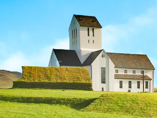
SKÁLHOLT MEDIEVAL CHURCH - SKÁLHOLT CATHEDRAL - SKÁLHOLTSKIRKJA
From 1056 to 1785, Skálholt Cathedral was one of Iceland's two episcopal sees (dioceses). The other is Hólar, 4 1/2h to the North.
Being an episcopal see made Skálholt an important center of religion, learning, culture and power and in 1075, Adam of Bremen described Skálholt as Iceland's "largest city".
Skálholt was home to 32 catholic bishops until, during the reformation to Lutheranism, the last Catholic bishop Jón Arason and his two sons were beheaded here in 1550. Afterwards, Skálholt was home to 13 Lutheran bishops until the see was moved to Reykjavík in 1801.
The cathedral that you currently see was built from 1956-1963 as a part of the millennial celebrations of the episcopal see. It is the 10th church that was built at this site.
It measures 30m in length; some its predecessors were reportedly up to 50m long.
Continue on route 35 to the south west for 20min to come to the next attraction.
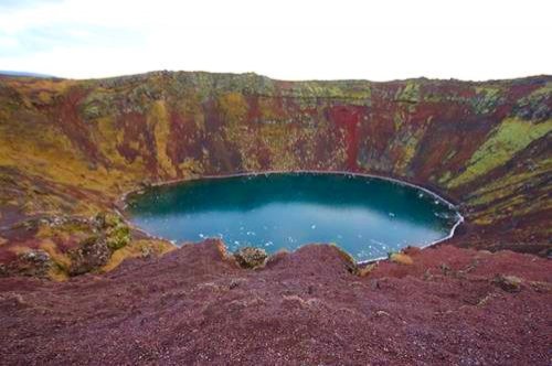
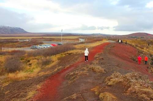
KERID CRATER (KERIÐ)
Kerið Crater is believed to be a cone volcano which erupted and the collapsed into its empty magma chamber. The water at the bottom of the crater is at the same level as the water table of the surrounding area. So, what you see is groundwater and not rainwater that accumulates in the crater.
Kerið Crater is one of several crater lakes in Iceland's Western Volcanic Zone, which was formed when the land moved over a localized hotspot. The caldera is the same red color as the other volcanic rock in the area and it measures approx. 560ft x 890ft (170m x 270m) and is 180ft (55m) deep. The water is fairly shallow and only 20-50ft (7-14m) deep. Its deep color is caused by minerals which are dissolved in the water.
Kerið Crater is about 3,000 years old and that makes it half the age of most other volcanic features in this area. Other sources claim it is about 6,500 years old and the same age as the other features in this area.
If you want to hike down to the water, you can do that. One of the walls is less steep than the others.
Kerið Crater is privately owned and you will need to pay admission.
If you have time, you can consider a 35min side trip to the Hellisheiði Power Station and their exhibition center which can be reached by continuing south on route 35, then turning right on route 1 and following it to the power plant.
HELLISHEIÐI POWER STATION (HGPS)
Hellisheiði Power Station is the third-largest geothermal power station in the world. It is operated by ON Power and produces 303 MW of electricity and 133 MWth of hot water.
The Geothermal Exhibition is open weekdays from 9am to 4pm. There you can visit the exhibition or sign up for guided tours that last 20-30min.

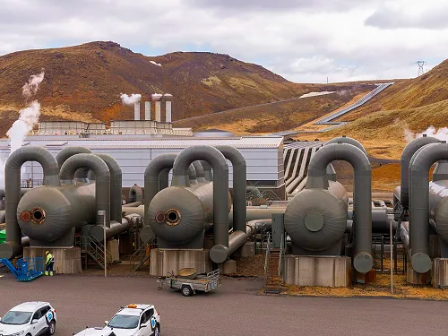
Co-located at the site is the Climeworks Orca plant that is carbon negative and will capture 4,000 tons of carbon dioxide per year and pump it underground where it will “mineralize”, meaning it will chemically react with the rock formations deep underground. This technology is one of many that can help combat climate change.
Now go back to route one and follow it west for 250ft (75m) and the turn left on route 39 which will bring you to the next destination after about 15min.
RAUFARHÓLSHELLIR LAVA TUBE
Raufarhólshellir is the 4th longest lava tube in Iceland. It formed about 5,600 years ago from a lava flow of the Leitahraun eruption about 6 miles (10 km) uphill from the cave.
Because irresponsible visitors had destroyed almost all of the fragile lava straws and left lots of trash, the cave was closed in 2016 and early 2017 to repair the damage, clear out several metric tons of trash and install a walkway and lighting. The cave is now open only for guided tours.
Different 1h and 3-4h packages are available. The standard 1h tour is available Saturdays and visitors can come to the cave or book transportation from Reykjavik.

Now that you have seen the highlights of the Golden Circle, you can treat yourself to an Icelandic dinner at one of the best restaurants in Iceland.
To get there, continue on route 39 eastbound. When route 39 turns into route 38, continue straight on (south) until you hit route 34, where you will make a left turn. Follow route 34 until route 33 branches off to the right. Route 33 will bring you into the tiny town of Stokkseyri. Follow the GPS directions in town to the restaurant.
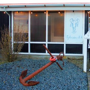
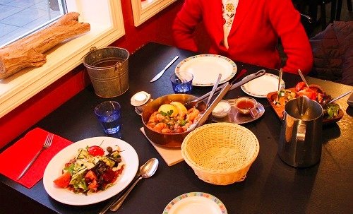
FJOERBORDID SEAFOOD RESTAURANT
Fjoerbordid Seafood Restaurant is one of the best seafood restaurants in Iceland. They are particularly known for their langoustine soup and langoustine tails. In case that you are not a seafood fan, worry not. They have excellent meat and vegetarian dishes too.
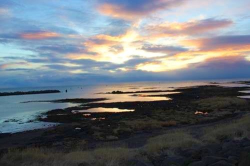
Before we went into the restaurant, we took a quick walk on the levee behind the restaurant and enjoyed the beach and beautiful sunset. It was definitely worth it.
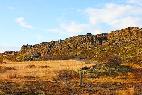
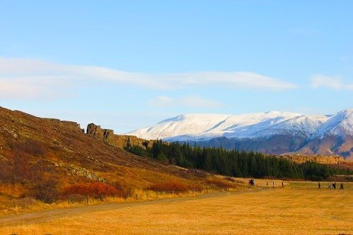
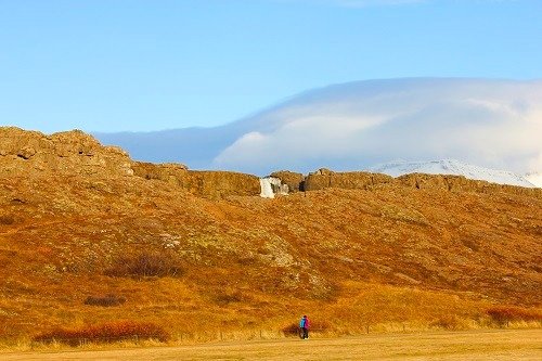
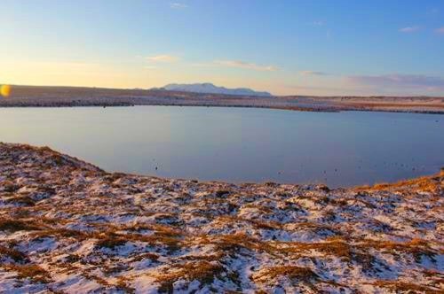
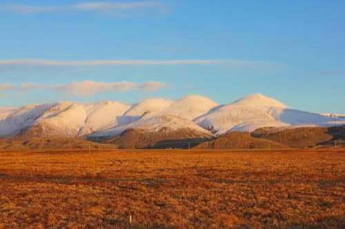
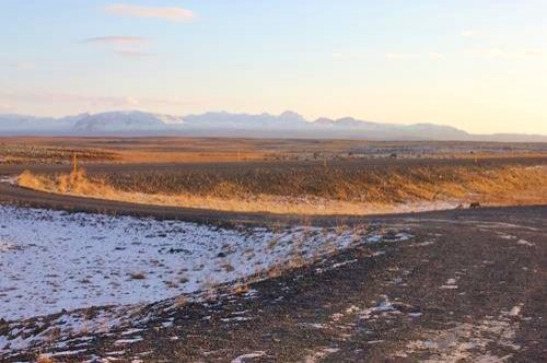
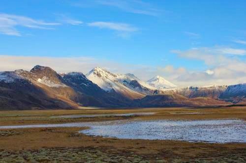
MORE PHOTOS TAKEN DURING THE GOLDEN CIRCLE TOUR
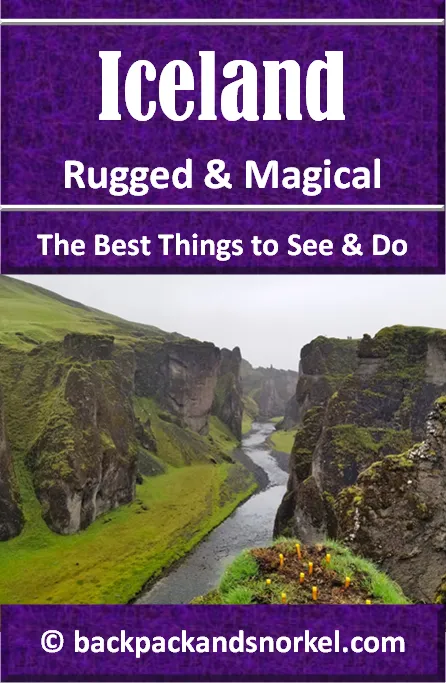
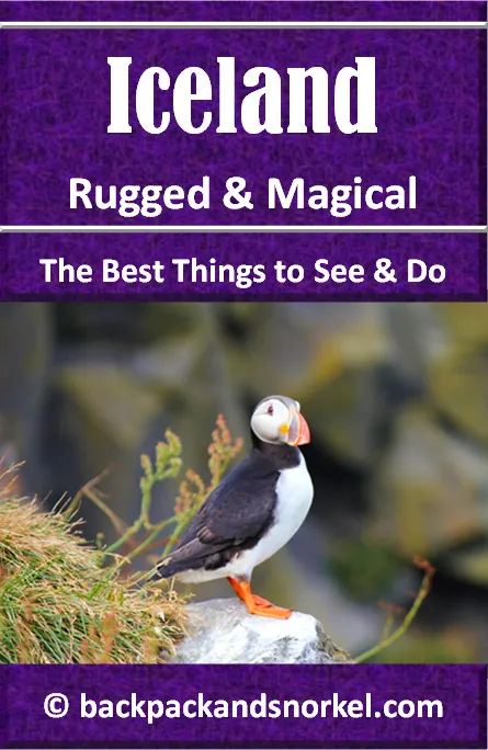
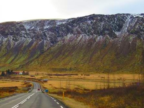
Iceland is a beautiful and rugged country. Below are some photos that we took
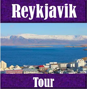
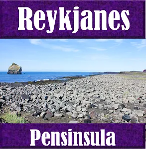
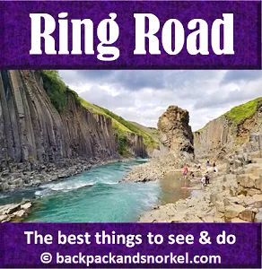
Here are more Iceland destinations to explore:
Author: Rudy at Backpack and Snorkel
Bio: Owner of Backpack and Snorkel Travel Guides. We create in-depth guides to help you plan unforgettable vacations around the world.

Other popular Purple Travel Guides you may be interested in:
Like this Backpack and Snorkel Purple Travel Guide? Pin these for later: