Travel Guide for EMERALD VIEW PARK - Pittsburgh Purple Travel Guide
We tell you why you should visit EMERALD VIEW PARK in the Pittsburgh area and what you need to know.
Emerald View Park, which used to be called Grand View Scenic Byway Park, was formed on Earth Day 2007 out of several smaller and isolated parks, playing fields, and vacant parcels. It is the 6th of the City of Pittsburgh’s municipal parks. The park wraps around parts of Pittsburgh’s Mount Washington, Duquesne Heights and Allentown neighborhoods, but is still not contiguous.
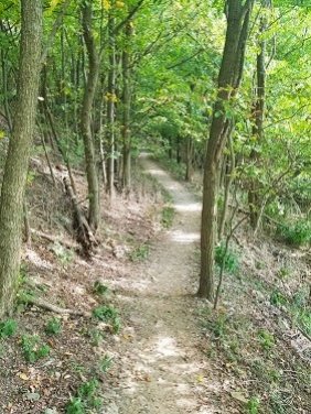
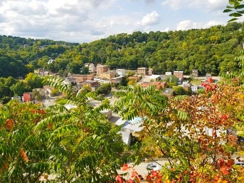
The park currently has 4 separate hikes with more planned. Our favorite hiking path is the 2.5 mile long Hike 1, as you have wonderful views on the city and other neighborhoods.
The trailhead is at a parking lot on Greenleaf Street. Should you drive up or down the steep part of Greenleaf Street starting or ending at Saw Mill Run Blvd, then please be advised that this is a narrow curvy 2-way street and you can often not see opposing traffic. So, please drive careful!!!
Before you start your hike, remember Right-Right-Left-Right. Those are how you need to turn at different forks on the trail.
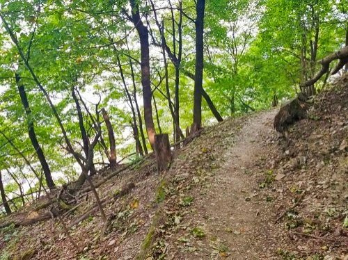
The trail is easy-to-moderate and, in some sections, there are steep slopes on the left hand side off the trail. So, I would suggest to not bring small kids and pets on this hike.
In summer, when all the trees have leaves, your view will often be obstructed. There are still opportunities to catch good views, but they are not as plentiful as if you come after all the leaves have fallen.
The first fork comes after maybe 10ft on the trail. Turn right here – you will come back later from the left hand side to finish Hike 1.
After maybe 1/4 mile, you will come to a fork. As I told you earlier, you will go right here.
For the curious: You can go left for maybe 30ft for a good view of the West End, but be careful the terrain goes steep down to the left of the trail and there is nothing that will catch you if you fall.
After a few more minutes, you will come to Greenleaf Street. Cross it – and be careful as some cars drive rather fast here - and go up Horner Street. At the end, Horner Street will turn back into the trail. Very soon, you will come to another fork and here you make a left. The path to the right will bring you back into the vicinity of your car.
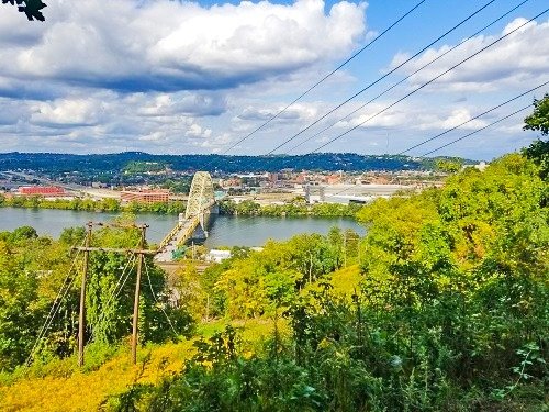
From now on the trail will give you great views of the North Shore and the Ohio River and later on of the Golden Triangle. Be careful as, in some areas, the terrain goes rather steep down to the left of the trail.
Follow this trail and enjoy the views through open areas in the tree lines.
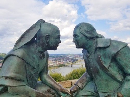
Towards the end of the hike, the trail will go uphill and you emerge from the forest. Soon, you will see some stones to the right where you can sit and take in the beautiful view of the Ohio and Golden Triangle. The trail ends at the Points of View Statue which shows George Washington and the Seneca leader Guyasuta, both with their weapons down, in a face-to-face meeting which happened in October 1770.
Once you are done taking in the views, walk west (left when you look at the statue with Grandview Ave to your back) on Grandview Ave, which ends at the Grandview Towers. Then make a left on Republic St and walk down all the way to the end of that street. At the end is a fence with an opening. This is where the last part of Hike 1 begins. Shortly after the start you will come to another fork. Here you make a right and continue up the hill until you come back to the parking lot. Shortly before you reach the parking lot, you will see the kissing trees. Believe it or not, both of them are alive.
Back to the Best Parks & Trails in Pittsburgh
Author: Rudy at Backpack and Snorkel
Bio: Owner of Backpack and Snorkel Travel Guides. We create in-depth guides to help you plan unforgettable vacations around the world.
Other popular Purple Travel Guides you may be interested in:
Like this Backpack and Snorkel Purple Travel Guide? Pin these for later:


