Backpack and Snorkel Travel Guide for Exploring the Irish Loop on the Avalon Peninsula in Newfoundland - Newfoundland Purple Travel Guide
Today, we are exploring part of the so-called Irish Loop on the Avalon Peninsula. We provide detailed information and a self-guided tour with the best things to see and we show lots of photos so you know what you can expect.
If you have an additional day, then you can make this a 2-day trip and visit the attractions that we have to skip.
The scenery during this trip is breathtaking. Make sure to stop frequently to enjoy the scenery.
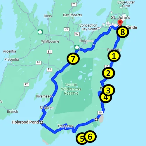
1 = The Tolt
2 = La Manche Provincial Park
3 = Colony of Avalon
4 = Berry Head Sea Arch
5 = Mistaken Point
6 = Cape Race Lighthouse
7 = Salmonier Nature Park
8 = Chafe's Landing Restaurant
We will do an abbreviated Irish Loop tour today:
What is the Irish Loop
The Irish Loop is a scenic 195-mile (312 km) loop route that starts south of St. John’s on Highway 10. The highway goes south all the way along the eastern side of Newfoundland’s Avalon Peninsula and then loops around the southern end, where it eventually turns into Highway 90. Highway 90 then loops back to St. John’s on the western side of the peninsula.
The name Irish Loop comes from the fact that this part of Newfoundland was settled mostly by the Irish starting in the 1600s, when a fishing Colony of Avalon was established and Irish servants and laborers were lured to settle here.
Eventually, many more communities were established by the Irish and even today, you will find quite a few people with Irish accents and Irish family names in this area.
If you have ever been in Ireland, the landscape here will remind you of the jagged cliffs and rolling green hills in Ireland.
The Tolt in Witless Bay
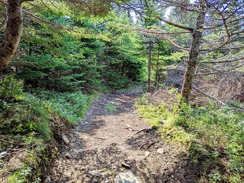
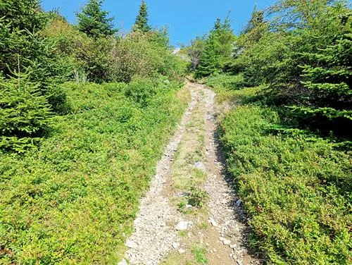
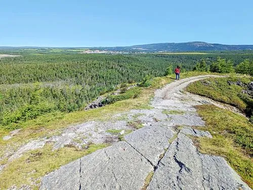
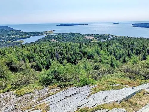
Make The Tolt your first stop. Pass the cemetery and take the first road to the right behind the cemetery. After 150 ft (50 m), you will see a small parking lot to the left of the road. Park there and then follow the road and walk up the hill. The trail is only 1,000 ft (300 m) and much of the trail is of moderate difficulty. The last ascend before the top, however, we rate it as moderate-difficult, as it goes steep up and it is difficult to get up and down, so be very careful.
The views from the top on the hills and bay are gorgeous.
La Manche Provincial Park
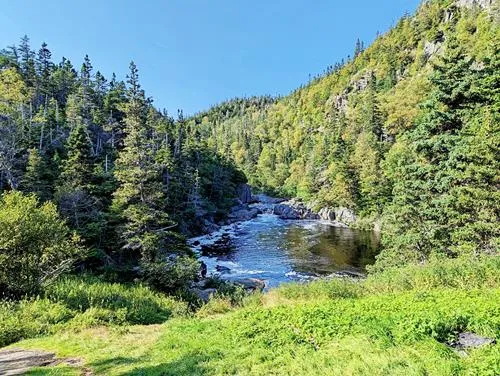
La Manche Provincial Park is a diverse park with lots of nature, hiking trails, a waterfall, a sandy beach, and opportunities to swim and kayak. The park is home to over 50 species of birds, including osprey, woodpeckers, gulls, and warblers.
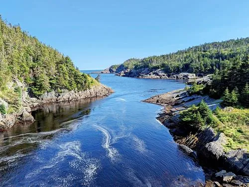
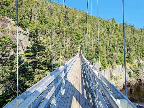
Near the 150 ft (50 m) suspension bridge, the foundations of old buildings from an abandoned fishing village called La Manche can still be seen. The village was abandoned in 1966, after a severe storm destroyed the community’s fishing infrastructure.
The suspension bridge is one of the most popular destinations in the park. To get there, do not use the official park entrance. Instead, continue on Highway 10 for 1 more mile (1.6 km) until you reach the road that leads to the suspension bridge. The road is bumpy with lots of potholes and does not require a high clearance vehicle at the time of writing.
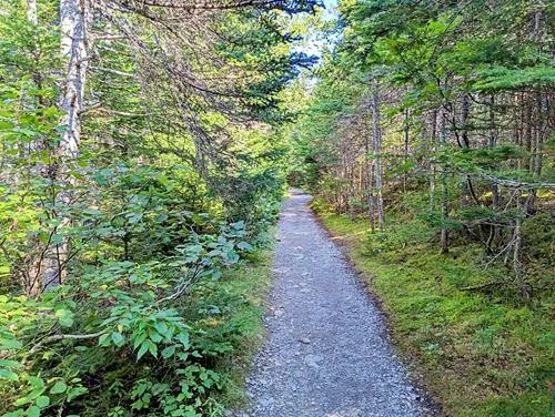
Drive this road to the end for 1.1 miles (1.8 km) and park your car. The trailhead can be found at the parking lot. The trail is of moderate difficulty. You will reach the suspension bridge after about ¾ of a mile (1.2 km).
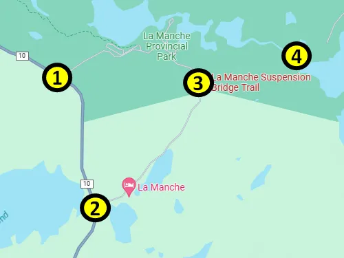
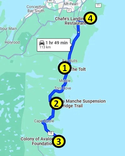
1 = La Manche Provincial Park Entrance
2 = Road to Suspension Bridge trailhead
3 = Suspension Bridge trailhead parking
4 = Suspension Bridge
Colony of Avalon
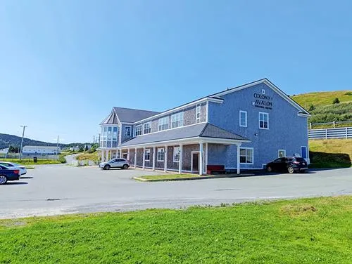
Located in the small town of Ferryland (less than 400 inhabitants), the Colony of Avalon was established by Edward Wynne for Sir George Calvert, the first Baron Baltimore, in 1621, after the land was granted to Calvert one year earlier.
The colony was the first successful permanent colony in Newfoundland. Four years after its founding, the population reached 100 people.
Ferryland was officially established by the English as a harbor for migratory fishermen in the late 1500s, but the area had been used by the French, Portuguese and Spanish before that. In the 1590s, Ferryland was one of the most popular fishing harbors in Newfoundland.
The Colony of Avalon was named after the mythical island of Avalon in the Arthurian legend.
Today, the colony is one of the earliest and best-preserved English colonial sites in all of North America.
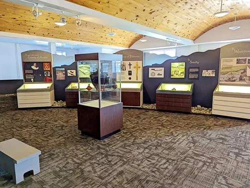
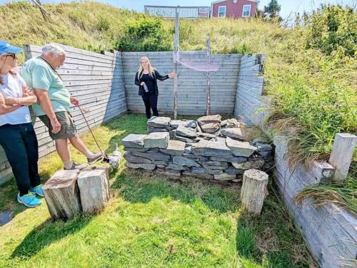
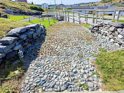
Excavations of the site showed that the colony had a cobblestone street, stone- and timber houses, a kitchen, a forge, a brewery, a cemetery, and a chapel that was used by Catholics and Protestants.
The colony was attacked by the Dutch in the 1660s and destroyed by the French in 1696 and then abandoned. It took almost 3 centuries to re-discover the site. Excavations of the site began in the late 1980s and continue to this day.
You can visit the site and even walk on a short section of the original cobblestone street. There is almost no signage that explains what you are seeing, so we strongly suggest joining one of the excellent guided tours between June and September.
After the guided tour, it is likely late afternoon and time to return to St. John’s.
If you feel like seeing more sights, consider these destinations:
- Ferryland Lighthouse
Built in 1871, this 46 ft (14 m) red-painted cylindrical tower lighthouse is still active. You can get there via an easy 1.5-mile (2.5 km) trail from the Colony of Avalon that takes about 25 min to complete one way. A popular activity is to book a picnic at the lighthouse. - Berry Head Sea Arch
The Berry Head Sea Arch can be reached via a 9 mile (14 km) one-way hike from Port Kirwan. At the arch, you can either continue the trail to Aquaforte, the trail deteriorates in quality and gets very muddy, or turn around. The trail is part of the East Coast trail and this section is called the Spurwink Island Path. - Mistaken Point Ecological Reserve
Mistaken Point got its name, because it poses a significant navigational hazard for ships near the often-foggy southeastern tip of Newfoundland’s Avalon Peninsula. It is one of the world’s most significant fossil sites. The fossil site can only be visited via one daily hiking tour that begins at the Edge of Avalon Interpretive Centre. This trail is rated as 4 mile (6 km) moderately difficult with uneven and wet and muddy surfaces, and some scrambling over rocks. - Cape Race Lighthouse
Cape Race Lighthouse is an active lighthouse that was built in 1856. The original lighthouse was replaced with the one that you see today in 1907 and the original was moved in front of the National Science and Technology Museum in Ottawa.
In 1904, a wireless radio station was set up at the lighthouse and in April 1912, it was the first station in the Americas that received the distress call of the Titanic. - Salmonier Nature Park
Salmonier Nature Park rehabilitates injured animals and educates people about animal and plant life on Newfoundland. The 1.2-mile (2.7 km) boardwalk trail leads visitors along the pens where the animals are located that are being rehabilitated and through scenic grasslands and forests.
Important: This is not a zoo - the pens could be empty when you get there.
dinner at Chafe's Landing
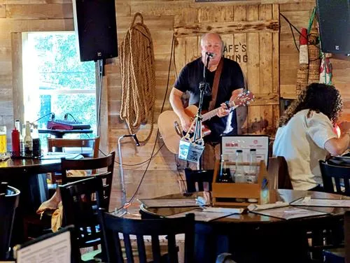
Located in Petty Harbour–Maddox Cove, a small town with less than 1,000 inhabitants south of St. John’s, the Chafe's Landing restaurant is a local favorite. It is so popular because of their delicious food, that it is advised to make dinner reservations.
Chafe's Landing specialize in seafood, but they have quite a few non-seafood dishes as well, including several moose dishes.

This concludes your tour for today.
What do you want to see next?
Where do you want to go now?
Author: Rudy at Backpack and Snorkel
Bio: Owner of Backpack and Snorkel Travel Guides. We create in-depth guides to help you plan unforgettable vacations around the world.
Other popular Purple Travel Guides you may be interested in:
Like this Backpack and Snorkel Purple Travel Guide? Pin these for later:


