Self-guided walking tour of Isla Mujeres
Immerse yourself in the charm of downtown Isla Mujeres with this expert-curated self-guided walking tour. We have mapped out a fantastic 2-3h route that takes you through the vibrant streets of El Centro.
Each stop along the tour includes detailed information about its history and significance, complemented by lots of photos to help you navigate and enjoy every moment of your exploration.
We also have a self-guided driving tour of the southern part of Isla Mujeres that allows you to see the rest of the island.
Explore El Centro: Your Self-Guided Isla Mujeres Walking Tour
The walking tour brings you to several Isla Mujeres signs. If you cannot get enough of those signs, there are two additional signs (A and B) that the tour does not bring you too, but that you can visit too.
Here is the route with 30 stops – you can skip stops 21 – 25 if you like (the exact google maps locations, as well as reviews and websites can be found in our Isla Mujeres Purple Travel Guide):

1. Ferry Pier
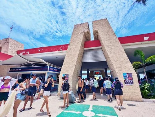
We begin our self-guided walking tour of the El Centro area of Isla Mujeres at the Ferry Pier, where you have most likely first set foot on this beautiful island.
The pier serves the Ultramar Ferry and Xcaret Catamaran, and it is located on the busiest street in Isla Mujeres: Av Rueda Medina.
Av Rueda Medina is the main shopping street and food street during the day in Isla Mujeres. You will find lots of stores and restaurants here.
If you look at the Ferry building from the street, then you will see the taxi stand to the right – this is the main taxi stand in Isla Mujeres.
A few feet to the left, you may see people waiting at a blue bus stop sign. This is the second designated stop for the Isleno Bus, which is a good and inexpensive way to explore the island.
From here, walk to the right (when you look at the ferry pier from the street) to the next stop.
2. Isla Mujeres Sign
In front of the shopping center, you will see the first Isla Mujeres sign.
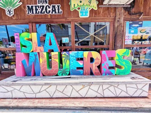
Continue your walk along busy Av Rueda Medina until you get to the next stop.
3. Playa Centro with Barracuda & Marlin Azul Monument
The beach that appears to your left is Playa Centro. It is the second-best beach on Isla Mujeres after Playa Norte, and much less busy.
Resist walking on the beach for a moment and continue walking along Av Rueda Medina, paying attention to the traffic signs that are mounted on the sidewalk. you will see the back of a rectangular sign that, on the other side is blue with a white bus on it. This is the main bus stop for Isleno Bus in Isla Mujeres.
About 240 ft (75 m) after the bus stop sign, you will reach the Barracuda & Marlin Azul Monument, which forms an arch through which you can walk onto beautiful Playa Centro.
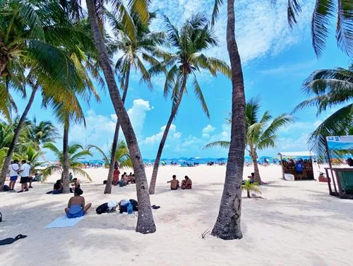
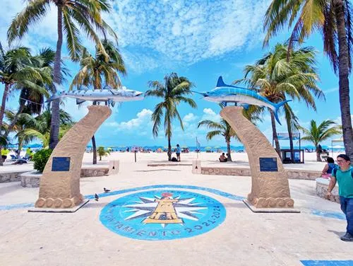
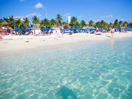
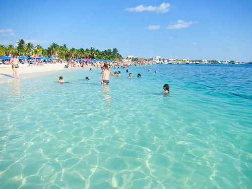
Continue walking along Av Rueda Medina until you get to the next stop.
4. Lighthouse
You will see the lighthouse on the other side of the street.
The official name of the lighthouse is: Faro de Punta Norte, meaning Lighthouse of the North Point.
The lighthouse is not open to the public.
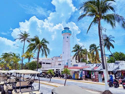
Continue walking along Av Rueda Medina until you get to the next stop.
5. El Pescador Statue
Inside the roundabout is the Fishermen statue El Pescador. It is dedicated to the fishermen of Isla Mujeres and the inscription reads: The Fisherman - Cristino Avila to his memory and to that of all those fishermen who with canoe and sail fought at sea in search of daily income.
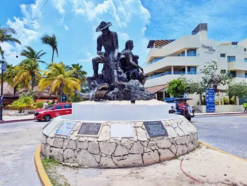
Make a 90 degree turn at the roundabout and walk along Adolfo Lopez Mateos, where the next stop is located.
6. Isla Mujeres Sign and Skeleton Bench
Past the side entrance of the luxury resort Privilege Aluxes and the Satay restaurant, you will find a store with an Isla Mujeres sign and a bench with a skeleton, two dolphins and lots of starfish and seashells.

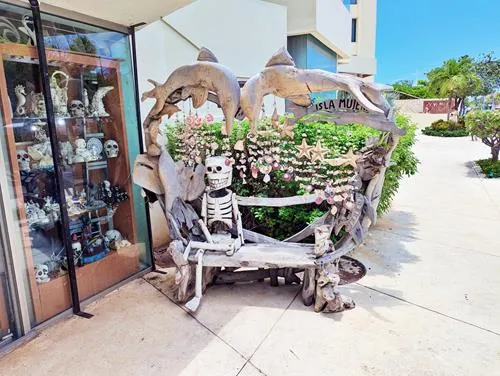
Continue your tour on Adolfo Lopez Mateos past the main entrance of the luxury resort Privilege Aluxes to the next intersection where your next stop is located.
7. Downtown Cemetery & Andres Quintana Roo Monument
At the intersection across the street, you can see a monument of Mexican politician, lawyer, and writer Andres Quintana Roo (1787-1851), who was one of the most influential men in the Mexican War of Independence. The Mexican state of Quintana Roo is named in his honor.
As a member of the Congress of Chilpancingo, Andres Quintana Roo presided over the National Constituent Congress, which drafted the Mexican Declaration of Independence in 1813.
The Andres Quintana Roo school behind the monument was built in 1964 and named him, too.

Across the street from the monument, you will see a painted wall, which encloses the downtown cemetery. You can see many colorful tombs and gravesites.


The cemetery contains the empty tomb of pirate Fermin Antonio Mundaca y Marecheaga.
You can find the tomb by entering the cemetery and taking the first walkway that branches off to the right. Walk as far as you can, and then make another right at the tomb that blocks your way. Look around, and you will see this tomb:

Who was Pirate Mundaca, and why is he famous?
Fermin Anonio Mundaca y Marecheaga was born in 1825 in Bermeo of Santa Maria, Spain. He made a fortune in the New World by capturing and selling Mayan slaves to plantations in e.g. Cuba, and probably also as a pirate – he bragged that he was a pirate, but there is no proof that has survived until today. In 1858, he settled down in Isla Mujeres, and built Vista Alegre (Happy View), a large hacienda that later covered over 40% of Isla Mujeres.
The hacienda housed livestock, vegetable and fruit gardens, and exotic plants. It also contained a sundial garden that was called: The Rose of the Winds.
Later in life, he fell in love with Martiniana (Prisca) Gomez Pantoja, nicknamed La Triguena (the brunette), who was born and raised in Isla Mujeres. She was reportedly ‘a willowy woman with green eyes, white skin bronzed by the Caribbean sun and long, straight hair’ who was 37 years younger than him.
To win her over, Mundaca dedicated the arches of his sprawling hacienda ‘The Entrance of the Triguena’, and the road ‘The Pass of the Triguena’.
Martiniana eventually married somebody else, and lonely Mundaca slowly went insane and lived the rest of his life in solitude, and later died in Merida.
At some time before his death, he carved the skull and crossbones on his tomb in the Downtown Cemetery and also the words: As you are, I was. As I am, you will be.
When you exit the cemetery, continue to the left for 2 more cross streets and turn into Av Guerrero where your next stop is located.
8. Post Office
In case you want to send a letter or postcard, this is the only post office that I know on the island.
Near the post office, you will see several street food vendors and their food carts. They are very popular with the locals for breakfast, lunch, and also for dinner.
Right behind the post office on Av Guerrero is your next stop.
9. Mercado Municipal
Mercado Municipal has some vegetable and fruit vendors inside the building. The restaurants by the parking lot are very popular with the locals for breakfast, and lunch.


Turn around and walk back to Adolfo Lopez Mateos, turn right, and make a left at the next intersection onto Carlos Lazo. Keep walking and you will pass the Isla Mujeres convention center, and the Zazil Ha kids waterpark.


Shortly before you reach Playa Norte Beach, you will see a road, also called Zazil-ha, branching off to the right. Enter this this road for about 120 ft (40 m) and you will see your next stop.
10. Mural
This is a beautiful mural.

Before you turn back, look further ahead into the road. At its end, you will see Playa Norte and a wooden bridge that leads to the MIA Reef Resort. Shortly before the bridge, on the right is budget hotel Villa Kiin. We are not going there right now, but will be there in a few minutes.
Turn around and walk back to Adolfo Lopez Mateos, turn right and you will soon be on beautiful Playa Norte beach, Mexico’s best beach.
11. Playa Norte Beach
Playa Norte is Mexico’s best beach. While Playa Norte has several entrance points, this is one of my favorites – and look at the hearts at the entrance.
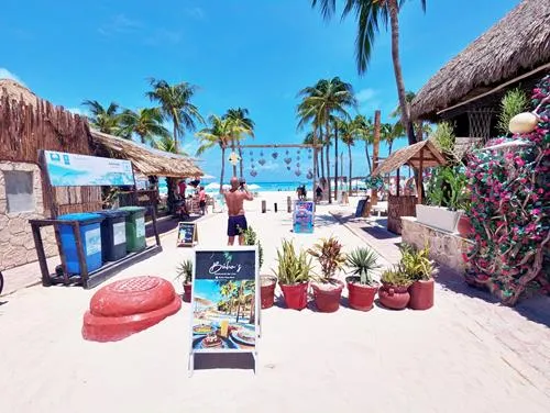
For your orientation: if you turn left on Playa Norte, you will come to lots of hotels, resorts, and beach bars. If you turn right, you will come to the widest part of Playa Norte, which is typically less busy, because there are no big resorts here.
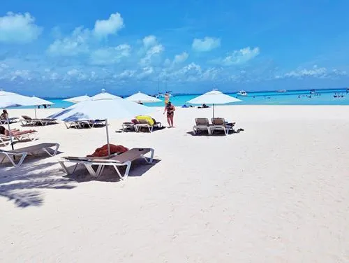

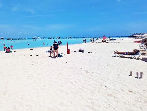
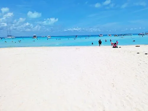
Our suggestion is to look around, and when you are done, make the right turn to where the sand turns 90 degrees to the right.
In front of you, you will see the island which houses the MIA Reef Resort with its pink painted original hotel building, and you will see the wooden bridge that you saw from the mural a few minutes ago.
Follow the beach, and pass by the wooden bridge to get to your next destination.
12. Playa Norte Lagoon – Caleta Nomada
Behind the bridge is the lagoon which, together with the far side of the bridge, has some of the best snorkeling in Isla Mujeres.
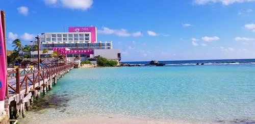
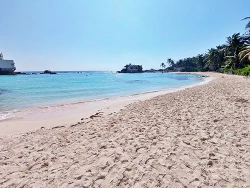
Keep walking along the lagoon beach, which is very popular with locals, until the beach ends and stairs lead up to the top of the rocks.
The house on the rocks near the water to your left is the house of Jose Lima, one of the most important pioneers who brought tourism to Isla Mujeres.
The house is called Casa de las Piedras, and it was the first architect designed house on the island. Jose Lima lived in this house until he passed away in 2009, at age 97.
Isla Mujeres was totally isolated from the rest of the world with the exception of a narrow dirt road through the jungle, and a connecting ferry, until 1959. In 1959, Jose Lima organized the first scheduled air flights from Merida to Isla Mujeres.
In 1964, he opened the Zazil-Ha hotel, which is now the MIA Reef Resort (book).
The house is now used for receptions for regatta participants, and other occasions. His family owns hotels, beach clubs and other businesses on Isla Mujeres, and are active in the Isla Mujeres Yacht club, hosting the Regattas.
Keep walking on the path, which turns right and leads you over the rocks to your next destination.
13. Playa La Media Luna – Half Moon Beach
Playa La Media Luna is named after the hotel of the same name that sits here.
Please be advised that the beach is for anyone, but the loungers and all services here are only for guests of Hotel Playa La Media Luna, and the adjacent Hotel Secreto.
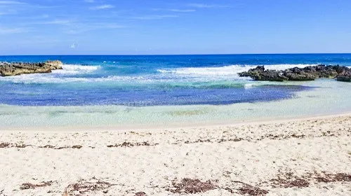
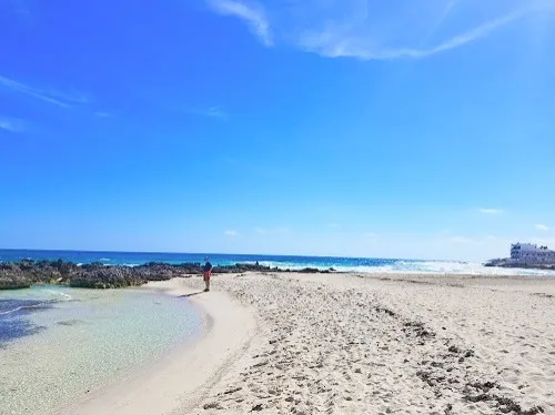
As beautiful as Playa La Media Luna is, do not go into the water under any circumstances. There are urchins, sharp underwater rocks, constant waves, and dangerous undercurrents in the water.
What you can do here, besides sunbathing, is look into the little pools in the rocky area. You will see plenty of small fish.
If you continue walking on the beach, you will see a second half-moon beach that ends where the Malecon starts. This beach is called Playa PocNa, after the hostel that once stood here and that is now Hotel Selina PocNa.
As with Playa La Media Luna, there are urchins, constant waves, and dangerous undercurrents in the water, and you must absolutely stay out of the water.
Walk to the end of the beach and up the stairs for your next destination.
14. Malecon
The Malecon in Isla Mujeres is about 0.6 miles (1 km) long. It starts after the steps from Playa PocNa and ends in the general area where the UltraCarga car ferry lands.
We will walk the entire length of the Malecon in this self-guided Isla Mujeres walking tour, but you can abbreviate it and leave the Malecon after the La Tortuga Monument (#20).

Continue on the Malecon for about 100 ft (30 m) to get to your next destination.
15. Isla Mujeres Sign
You are now standing at the largest Isla Mujeres sign.
This Isla Mujeres sign, like some others too, this one has been totally redone a few years ago. Gone are the colorful letters and the flower - the current sign is less colorful but features various Mexican-style mosaics, which makes it truly unique.
And, unlike other Isla Mujeres signs, here you can take photos with the beautiful ocean in the background.
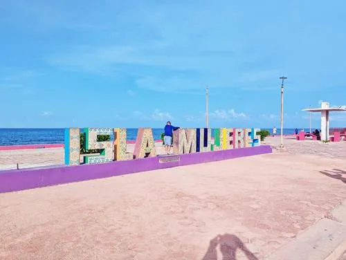
Turn around, and look straight to the south. This is your next destination.
16. Mural
Painted on one wall of the Ocean Drive Hotel & Studios is a beautiful mural.

Continue walking on the Malecon for about 450 ft (140 m), to an area with several monuments.
17. La Triguena Statue
The La Triguena Statue represents an artist’s rendition of Martiniana (Prisca) Gomez Pantoja, nicknamed La Triguena (the brunette), who played a tragically important role in Pirate Mundaca’s life.
She is shown emerging from a conch shell, holding a starfish in both hands towards the stars.
The inscription translated means:
The brunette
The native woman with her incomparable
Beauty is impregnated with
Sea breeze with air
Towards the stars

Turn towards the west, and look at the building that has two statues in front of it. The next stop is the statue close to you.
18. Francisco Hernandez de Cordoba Statue
The Statue shows Francisco Hernandez de Cordoba, who discovered and named Isla Mujeres in March 1517.

Cordoba is mostly known for his ill-fated expedition to the Yucatan Peninsula. Only extraordinarily little is known about his prior life – he was wealthy, owned a landed estate, including a native town, he financed his expedition to the Yucatan, and likely had participated in the conquest of Cuba.
Three ships and a crew of 116 men under the command of Cordoba left Santiago de Cuba in Cuba on February 8, 1517, to explore an unexplored area to the south that we now call the Yucatan Peninsula of Mexico, and likely also for slaves.
On March 1, 1517 they discovered an uninhabited island and called it Isla Mujeres, after seeing sculptures of women in an indigenous temple.
Cordoba and his crew made friendly contact with the natives at Cabo Catoche on March 4, 1517.
There is a story that the Spaniards asked the Indians how they called their land, and the natives apparently replied, ‘I don't understand what you said’, which sounded like ‘Yucatan’ in their language. They also said ‘Cotoch’ meaning: our houses, our homeland. To the Spaniards it sounded like Catoche and they named the settlement Catoche and the region Yucatan.
The following day, the natives offered to shuttle the Spaniards from their ships to their city again, but there were many more natives on land, and that raised the alarms with the Spaniards. Out of caution, they brought some weapons with them.
Their fears came true on land when the Spaniards were ambushed. Due to their superior weapons, the Spaniards were able to stand their ground, and force the natives to retreat.
The Spanish soldiers and their effective weapons, and a lot of curiosity and valor even enabled the chaplain of the expedition Gonzalez to explore and plunder Maya idols from native shrines and a pyramid, before they all retreated to their ships with two captured natives. At least two Spaniards died - it is not known how many natives perished.
The Mayan idols sparked the Spaniards’ interest, as they were partly made out of gold!
The Spaniards then left the area and kept sailing slowly only during the days, convinced that Yucatan was an island. For the next 15 days, their water supplies dwindled as they did not see any rivers.
On the 15th day, they discovered the Mayan village of Campeche. Again, the natives were friendly in the beginning and allowed the Spaniards to refill their water containers.
After meeting their first Mayan priests, the Spaniards sensed that the natives were preparing to attack them, so they retreated to their ships and left.
After another ten days of sailing, which included four days of a violent storm, their water supplies were exhausted again, and they had no choice to stop near a town that is nowadays called Champotn.
They refilled their water containers, but were soon surrounded by large numbers of natives. After spending the night on land, the natives attacked, outnumbering the Spaniards 300 : 1. Soon after the battle began, it was basically over as all but one soldier were wounded, and the fallen natives were substituted with fresh warriors.
During the battle, Cordoba was hit by twelve arrows.
The Spaniards still alive then formed a close phalanx and broke through the lines of native warriors and reached their boats. The natives were able to capsize some of the boats, but most Spaniards were picked up other boats, and retreated to their ships.
55 Spaniards were killed, 5 would die in the coming days, two were taken (and likely sacrificed) by the natives, no water rations were brought back, and only one person of the expedition was not injured. Cordoba was gravely injured, but survived.
The Spaniards named the place ‘La Costa de Mala Pelea’ meaning: coast of the evil battle.
The remaining crew was unable to operate three ships, so one was stripped of anything valuable and then burned.
The crew was without water for days, and forced to drink brackish water at a place that had large alligators – consequently, they called El Estero de los Lagartos.
Instead of sailing back to Cuba, it was believed that it was safer to sail to Florida first.
At their fresh water stop in Florida, they were again attacked by natives, but this time they won the battle and stocked on fresh water for the trip to Cuba.
Back in Havana, Cordoba and 3 soldiers dies within days of their injuries.
A few feet away is another statue, and this is your next stop.
19. Statue
On the other end of the building is another bust, unfortunately, we don’t know who it represents.
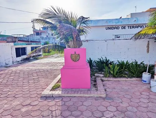
Go back to the Malecon and walk another 320 ft (100 m) to your next destination.
20. La Tortuga Monument
The inscription on tis monument translated says:
The turtle
Beautiful species in danger of extinction
Perpetuated in this monument
In its honor

You will now need to decide if you want to continue on the Malecon to the Mosaic House, or take a shortcut to Parque Principal Isla Mujeres (#26).
To get to the Mosaic House, continue on the Malecon for another 1,000 ft (300 m) and marvel at the beautiful ocean and its energetic waves that are constantly crashing into the reef on the Caribbean side of Isla Mujeres.
Otherwise walk down the stairs on the other side of the La Tortuga Monument, and cross Av Guerrero to get to Parque Principal Isla Mujeres (#26).
21. Mosaic House
A house with a beautiful mosaic and ornaments covering its entrance to the Malecon.

Continue to the second next house, which is your next stop.
22. Mosaic House
A house with a beautiful mosaic covering its entrance to the Malecon.

Continue on the Malecon for another 620 ft (190 m) to your next stop.
23. Tile House
A house with beautiful tiles and ornaments covering its entrance to the Malecon.

From here it is another 580 ft (175 m) until the Malecon ends and a compacted dirt path leads you to Av Juarez.
At Av Juarez, look right and you will see your next destination.
24. Benito Juarez Garcia Monument
This monument honors Benito Pablo Juárez García, who was the 26th president of Mexico from 1858 until his death in office in 1872. He was of Zapotec ancestry, and the first and only indigenous president of Mexico.
Benito Juarez was born in Oaxaca in 1806 to a poor, rural, Zapotec family, and orphaned as a child.
He was elected Governor of Oaxaca, before taking over federal posts, including Minister of Justice, and President of the Supreme Court.

Look left and walk westwards towards the ocean, and make a right at the next intersection, but don’t cross Av Rueda Medina – stay on the right side and walk about 1,150 ft (360 m) to your next destination.
25. Colorful Stairs
While you walk north on Av Rueda Medina, look to your right between buildings. At one point, you will see these colorful stairs.
Disclaimer: These are not the Rainbow Stairs that people may have told you about.
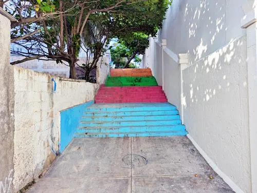
Continue walking on Av Rueda Medina for another 520 ft (160 m) until you see the entrance to the ferry pier where you started on your left. To your right is Calle Bravo. Take it and walk for two blocks until you see a basketball court to your left. Cross the basketball field and you arrive at your next destination.
26. Parque Principal Isla Mujeres with Statue
Parque Principal gets busy in the evenings with lots of locals, tourists, and food stands. It is particularly beautiful when everything is decorated for Christmas.
The park hosts a big New Year’s Eve party every year.
During the day, you can see younger people play on the basketball court.
The park has another stature of a man, whose identity we don’t know.
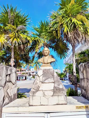
Look towards the western side of Parque Principal for your next destination.
27. Super Aki Supermarket
On the western side of Parque Principal is the Super Aki Supermarket, which is the biggest supermarket in El Centro, the Isla Mujeres downtown area.
Its square footage is, however, only a tiny fraction of Isla Mujeres’ largest supermarket Chedraui, which is about two miles to the south from here.
Your next destination lies on the opposite (eastern) side of Parque Principal.
28. Parroquia Inmaculada Concepción
The ‘Our Lady of Immaculate Conception Catholic Church’ Parroquia Inmaculada Concepción with a statue of the Virgin Mary on its roof top dominates Parque Principal.
Locked up in a display case right of the altar sits a statue that dates back to the Spanish conquest.
In 1890, fishermen found three Virgin Mary statues in a deserted colonial settlement on Isla Mujeres called Ecab. The statues were made of wood, but had porcelain faces and hands. The true story of the statues is unknown, but it is believed that they were gifts from the Spanish when they visited in 1770.
One statue was temporarily housed in a small wooden chapel, while Parroquia Inmaculada Concepción was being built, and the other two were gifted to the city of Izamal (Yucatan), and Kantunikin (Quintana Roo).
There is a legend that says that the chapel burst in flames when the statue was removed, and some locals still believe that, from dusk till dawn, the statue walks on the water around Isla Mujeres looking for her sisters.
The statue can be found in a display case right of the altar. Every year from November 29 until December 8, various religious festivities take place at the church. On December 8, the statue is removed from the case and paraded around the island.

Now walk back towards Super Aki and then turn left (south) on Av Morelos for one full block to the intersection with Av Juarez. Your next stop is here.
29. Lighthouse (El Faro) Pharmacy
This pharmacy has a beautiful lighthouse façade.

Now walk back towards Parque Principal, but turn left at Miguel Hidalgo right before you reach the plaza.
30. Miguel Hidalgo
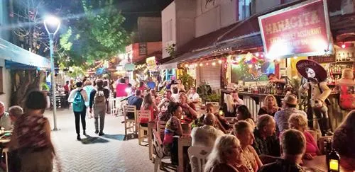
This pedestrian street is the main dining, amusement, and shopping street in the evenings. It is about a ¼ mile (450 m) stretch of pedestrian street where you find restaurants, bars, hotels, souvenir stores, and other stores side-by-side.
After dark this is where you will find mostly tourists having a fun time after dark.



This concludes your self-guided walking tour of El Centro / Downtown Isla Mujeres.
There are two Isla Mujeres signs that were not part of the tour, but that you can visit if you like.
A. Isla Mujeres Sign
This Isla Mujeres sign is located on Playa Norte beach next to the beach bar by the Ixchel Beach hotel.
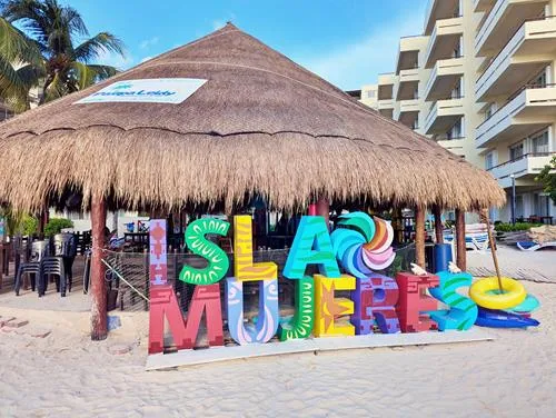
B. Isla Mujeres Sign
This Isla Mujeres sign is located on Playa Centro beach near Muelle 3 / Dock 3.

Author: Rudy at Backpack and Snorkel
Bio: Owner of Backpack and Snorkel Travel Guides. We create in-depth guides to help you plan unforgettable vacations around the world.
Other popular Purple Travel Guides you may be interested in:
Like this Backpack and Snorkel Purple Travel Guide? Pin these for later:
